INDIA | FlySight has expanded its global presence

Apr 4, 2024

FlySight has broadened its global footprint through a strategic collaboration with Suretech International, the technology sourcing firm in India led by Mr. R.K. Chanana, with over 25 years of experience, specializes in consulting for the establishment of new industrial projects in India.

Suretech International is dedicated to introducing emerging technologies on a global scale in India, aligning them with the country’s future growth requirements. The company is committed to facilitating the import and localization of technologies to meet India’s strategic needs, aiming to bridge the gap between India and the international market while fostering the exchange of technologies and products.

As India emerges on the international stage, there is a growing demand for cutting-edge technologies that align with the nation’s aspirations for economic growth and technological advancement. This collaboration not only shore up FlySight’s presence in India but also underscores the significance of international partnerships in the dynamic technology and business landscape.

The strategic agreement between FlySight and Suretech International is poised to promote OPENSIGHT solutions, as a testament to the importance of fostering international collaborations to navigate the evolving landscape of advanced technology and business.

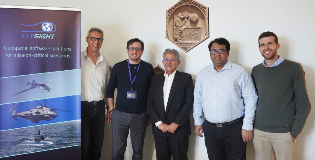
From left: Emilio Simeone, President of FlySight, Andrea Masini, CEO of FlySight with the Founder of Suretech International Mr. R.K. Channa and his Vice President Shashank Jha and Mattia Carpin, Head of Engineering at FlySight.

OPENSIGHT Augmented Reality System

The perfect solution for any possible scenario

Discover if OPENSIGHT can meet your needs

Contact us now to have more information on a specific product.
We’ll get back as soon as we can.

Want to be always

up to date?

[/et_pb_column]
[/et_pb_row]
[/et_pb_column]

FlySight is proud to announce the official release of MAP CREATOR, a cutting-edge software tool developed to radically simplify and accelerate the preparation of map datasets for real-time 3D visualization.

Designed as a core component of the OPENSIGHT platform, MAP CREATOR allows users to transform raster, elevation, and vector data into optimized MBTILES — a standard format for tiled offline maps — with just a few clicks.

MAP CREATOR boasts a modern, intuitive Graphical User Interface (GUI) that eliminates the need for command-line skills or programming knowledge. Users can upload individual files or entire folders, preview content, apply smart styling rules, and generate ready-to-use map packages in record time. The tool supports a wide variety of geospatial formats, including TIFF, JPG, PNG, ECW, DTED (DT0, DT1, DT2), and shapefiles (.shp), ensuring flexibility across both commercial and defense applications.

What truly sets MAP CREATOR apart is its deep integration with OPENSIGHT Mission Console, making it not just a pre-processing tool but a strategic asset for mission planning and real-time operations.

Avionic Operators can now generate, preview, and load custom maps directly into the console environment — enhancing situational awareness and reducing reliance on external processing tools.

Among its standout features are:

⚙️ Smart vector styling with attribute-driven rules

⚙️ Support for terrain-aware vector rendering using elevation sources

⚙️ 3D extrusion and label rendering for intuitive map outputs

⚙️ High-performance raster and elevation tiling with multiprocessing support

⚙️ Advanced MBTILES merging to build seamless base layers and overlays

MAP CREATOR represents a major step forward in geospatial usability,” said Mattia Carpin, Head of Engineering at FlySight. “It combines the technical power of our SDK with the simplicity and visual control today’s users expect.

MAP CREATOR is now available as part of the latest OPENSIGHT SDK and with OPENSIGHT Mission Console. For demos, licensing, or partnership inquiries, contact FlySight’s commercial team.

FlySight team constantly develops cutting-edge solutions to provide real-time support in defence and security operations decision making.

Subscribe to our newsletter to be always updated with our latest innovations!

[/et_pb_section][/et_pb_column]
[/et_pb_row]
[/et_pb_column]

FlySight is proud to announce the official release of MAP CREATOR, a cutting-edge software tool developed to radically simplify and accelerate the preparation of map datasets for real-time 3D visualization.

Designed as a core component of the OPENSIGHT platform, MAP CREATOR allows users to transform raster, elevation, and vector data into optimized MBTILES — a standard format for tiled offline maps — with just a few clicks.

MAP CREATOR boasts a modern, intuitive Graphical User Interface (GUI) that eliminates the need for command-line skills or programming knowledge. Users can upload individual files or entire folders, preview content, apply smart styling rules, and generate ready-to-use map packages in record time. The tool supports a wide variety of geospatial formats, including TIFF, JPG, PNG, ECW, DTED (DT0, DT1, DT2), and shapefiles (.shp), ensuring flexibility across both commercial and defense applications.

What truly sets MAP CREATOR apart is its deep integration with OPENSIGHT Mission Console, making it not just a pre-processing tool but a strategic asset for mission planning and real-time operations.

Avionic Operators can now generate, preview, and load custom maps directly into the console environment — enhancing situational awareness and reducing reliance on external processing tools.

Among its standout features are:

⚙️ Smart vector styling with attribute-driven rules

⚙️ Support for terrain-aware vector rendering using elevation sources

⚙️ 3D extrusion and label rendering for intuitive map outputs

⚙️ High-performance raster and elevation tiling with multiprocessing support

⚙️ Advanced MBTILES merging to build seamless base layers and overlays

MAP CREATOR represents a major step forward in geospatial usability,” said Mattia Carpin, Head of Engineering at FlySight. “It combines the technical power of our SDK with the simplicity and visual control today’s users expect.

MAP CREATOR is now available as part of the latest OPENSIGHT SDK and with OPENSIGHT Mission Console. For demos, licensing, or partnership inquiries, contact FlySight’s commercial team.

FlySight team constantly develops cutting-edge solutions to provide real-time support in defence and security operations decision making.

Subscribe to our newsletter to be always updated with our latest innovations!

[/et_pb_section]