
Empowering every platform elevating every mission
OPENSIGHT is a multi-platform PED (Processing, Exploitation and Dissemination) system created to provide the best support in decision making. It integrates a geo-exploitation toolbox which represents a new environmental concept for mission data analysis and visualization.
OPENSIGHT has been developed following the STANAG guidelines and rules. More than 10 years of experience, gained from working on interfacing software tools for airborne data sensors and avionics information processing.


Key features
- 5Independent platforms (workstation, desktop or mobile, all operative systems)
- 5Modular plugins (each plugin is exportable as a standalone application or library)
- 5Fully customizable and extensible through a simple SDK (Software Development Kit) for specific applications
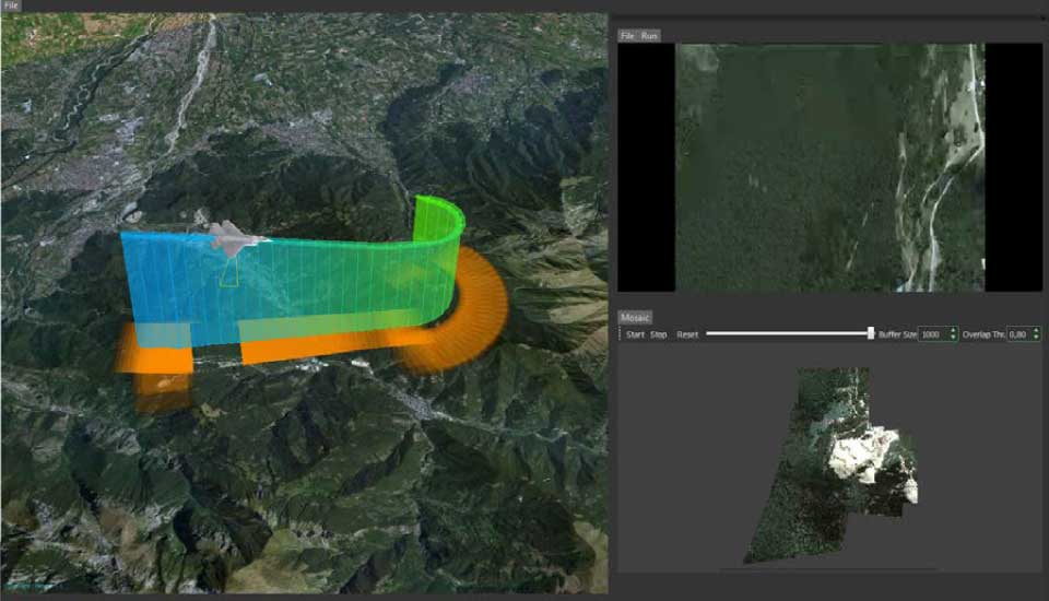
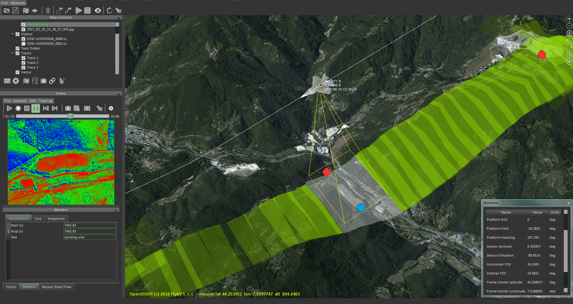
reality processing
- 5Real information exploiting in a synthetic environment for scenarios analysis and forecasting
- 5Simultaneous GIS and 3D graphics rendering capabilities
- 5Real-time and mission archived data visualization and management
Open Software License
- 5Customizable in every aspect
- 5Any new functionality can be added
DEVELOPMENT TOOLS
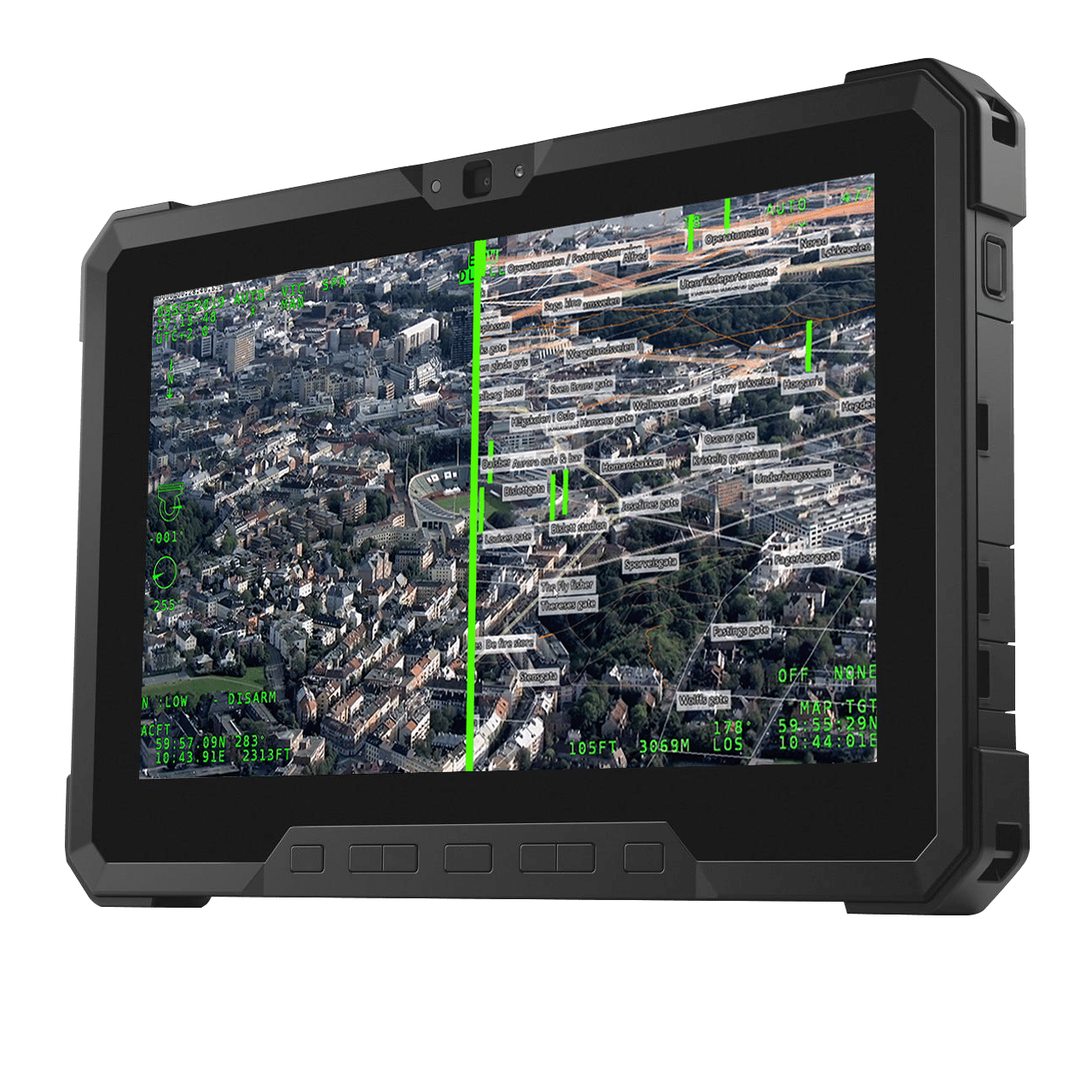
Geospatial situational awareness
Real-time augmented reality
Detection, classification, identification
TURNKEY TOOLS
Real-time mission analysis
and dissemination
On-ground analyst console
Real-time processing
of optronic mast sensor
From traditional Earth observation to Earth information & intelligence
PLUGINS
Want to know more about OPENSIGHT?
Designed and developed to meet specific needs in any scenario, OPENSIGHT is a multi-platform PED (Processing, Exploitation and Dissemination) system created to provide the best support in decision making.
Contact us, our team is here to help!