FlySight to Showcase at National Underwater Center Inauguration

Dec 4, 2023

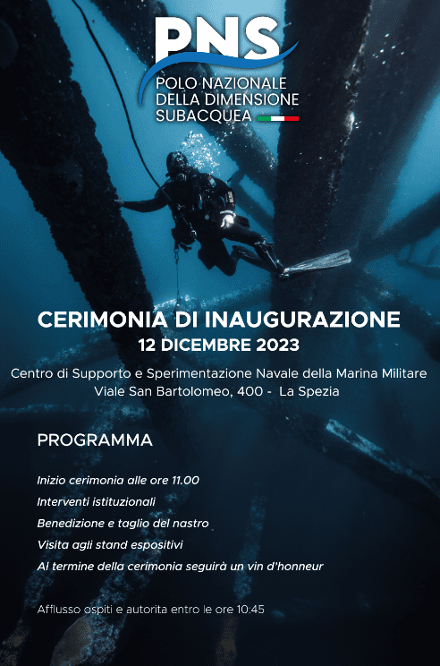
FlySight is gearing up to exhibit at the inauguration ceremony of the 𝐏𝐍𝐒 (𝐏𝐨𝐥𝐨 𝐍𝐚𝐳𝐢𝐨𝐧𝐚𝐥𝐞 𝐝𝐞𝐥𝐥𝐚 𝐝𝐢𝐦𝐞𝐧𝐬𝐢𝐨𝐧𝐞 𝐒𝐮𝐛𝐚𝐜𝐪𝐮𝐞𝐚), the National Underwater Center scheduled for Tuesday, December 12th. The National Underwater Center is set to officially open its doors on the 12th of December. As outlined in the recently released multi-year programmatic document for Defense covering 2023-2025, it will serve as an “aggregator and accelerator of all national expertise, including industry, research, and academia.”

The center is poised to become a hub of research excellence in the security sector, situated within what is being envisioned as the “Blue Mile”, a little more than a nautical mile in La Spezia (IT), where you will find much of the best in the world in the ability to create pleasure ships.
The Underwater Center aims for international prominence. Established under the aegis of the Italian Navy, it builds upon the expertise of the Center for Support and Naval Experimentation and the NATO Center for Maritime Research and Experimentation. The CSSN is now part of the NATO network known as Defense Innovation Accelerator for the North Atlantic (DIANA), which encompasses two testing and experimentation centers in Italy: Turin and La Spezia.

The focus of this domain will revolve around unmanned vehicles, signaling a future where unmanned systems will play a crucial role in operations and FlySight’s engagement encompasses several key initiatives in supplies sophisticated software components designed for the management of unmanned systems. These components enrich situational awareness in the broader tactical context and streamline data processing by leveraging artificial intelligence capabilities.

FlySight is committed to making available the already developed advanced software components for managing multidomain and interoperable unmanned teams. This commitment extends to bringing into the underwater domain all the well-tested functionalities that FlySight has established in the air and on-ground domains.

🌊 Discover more about our solutions for underwater and maritime operations

Discover if OPENSIGHT can meet your needs

Contact us now to have more information on a specific product.
We’ll get back as soon as we can.

Want to be always

up to date?

[/et_pb_column]
[/et_pb_row]
[/et_pb_column]

FlySight is proud to announce the official release of MAP CREATOR, a cutting-edge software tool developed to radically simplify and accelerate the preparation of map datasets for real-time 3D visualization.

Designed as a core component of the OPENSIGHT platform, MAP CREATOR allows users to transform raster, elevation, and vector data into optimized MBTILES — a standard format for tiled offline maps — with just a few clicks.

MAP CREATOR boasts a modern, intuitive Graphical User Interface (GUI) that eliminates the need for command-line skills or programming knowledge. Users can upload individual files or entire folders, preview content, apply smart styling rules, and generate ready-to-use map packages in record time. The tool supports a wide variety of geospatial formats, including TIFF, JPG, PNG, ECW, DTED (DT0, DT1, DT2), and shapefiles (.shp), ensuring flexibility across both commercial and defense applications.

What truly sets MAP CREATOR apart is its deep integration with OPENSIGHT Mission Console, making it not just a pre-processing tool but a strategic asset for mission planning and real-time operations.

Avionic Operators can now generate, preview, and load custom maps directly into the console environment — enhancing situational awareness and reducing reliance on external processing tools.

Among its standout features are:

⚙️ Smart vector styling with attribute-driven rules

⚙️ Support for terrain-aware vector rendering using elevation sources

⚙️ 3D extrusion and label rendering for intuitive map outputs

⚙️ High-performance raster and elevation tiling with multiprocessing support

⚙️ Advanced MBTILES merging to build seamless base layers and overlays

MAP CREATOR represents a major step forward in geospatial usability,” said Mattia Carpin, Head of Engineering at FlySight. “It combines the technical power of our SDK with the simplicity and visual control today’s users expect.

MAP CREATOR is now available as part of the latest OPENSIGHT SDK and with OPENSIGHT Mission Console. For demos, licensing, or partnership inquiries, contact FlySight’s commercial team.

FlySight team constantly develops cutting-edge solutions to provide real-time support in defence and security operations decision making.

Subscribe to our newsletter to be always updated with our latest innovations!

[/et_pb_section][/et_pb_column]
[/et_pb_row]
[/et_pb_column]

FlySight is proud to announce the official release of MAP CREATOR, a cutting-edge software tool developed to radically simplify and accelerate the preparation of map datasets for real-time 3D visualization.

Designed as a core component of the OPENSIGHT platform, MAP CREATOR allows users to transform raster, elevation, and vector data into optimized MBTILES — a standard format for tiled offline maps — with just a few clicks.

MAP CREATOR boasts a modern, intuitive Graphical User Interface (GUI) that eliminates the need for command-line skills or programming knowledge. Users can upload individual files or entire folders, preview content, apply smart styling rules, and generate ready-to-use map packages in record time. The tool supports a wide variety of geospatial formats, including TIFF, JPG, PNG, ECW, DTED (DT0, DT1, DT2), and shapefiles (.shp), ensuring flexibility across both commercial and defense applications.

What truly sets MAP CREATOR apart is its deep integration with OPENSIGHT Mission Console, making it not just a pre-processing tool but a strategic asset for mission planning and real-time operations.

Avionic Operators can now generate, preview, and load custom maps directly into the console environment — enhancing situational awareness and reducing reliance on external processing tools.

Among its standout features are:

⚙️ Smart vector styling with attribute-driven rules

⚙️ Support for terrain-aware vector rendering using elevation sources

⚙️ 3D extrusion and label rendering for intuitive map outputs

⚙️ High-performance raster and elevation tiling with multiprocessing support

⚙️ Advanced MBTILES merging to build seamless base layers and overlays

MAP CREATOR represents a major step forward in geospatial usability,” said Mattia Carpin, Head of Engineering at FlySight. “It combines the technical power of our SDK with the simplicity and visual control today’s users expect.

MAP CREATOR is now available as part of the latest OPENSIGHT SDK and with OPENSIGHT Mission Console. For demos, licensing, or partnership inquiries, contact FlySight’s commercial team.

FlySight team constantly develops cutting-edge solutions to provide real-time support in defence and security operations decision making.

Subscribe to our newsletter to be always updated with our latest innovations!

[/et_pb_section]