The FlySight team through the eye of the camera

Feb 21, 2023

Lights, camera, action!

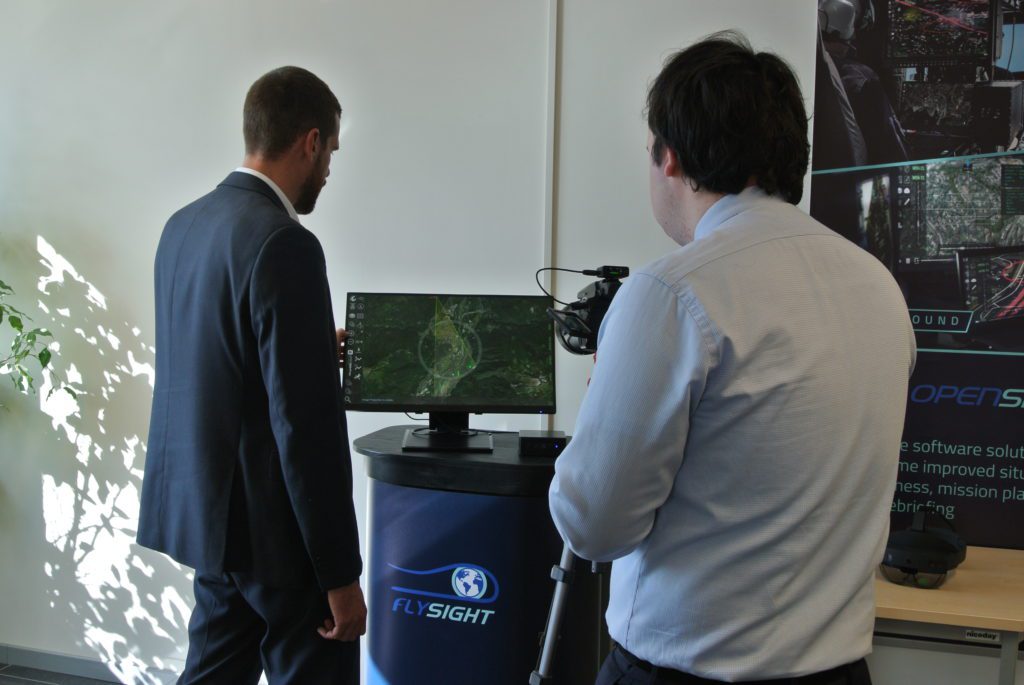
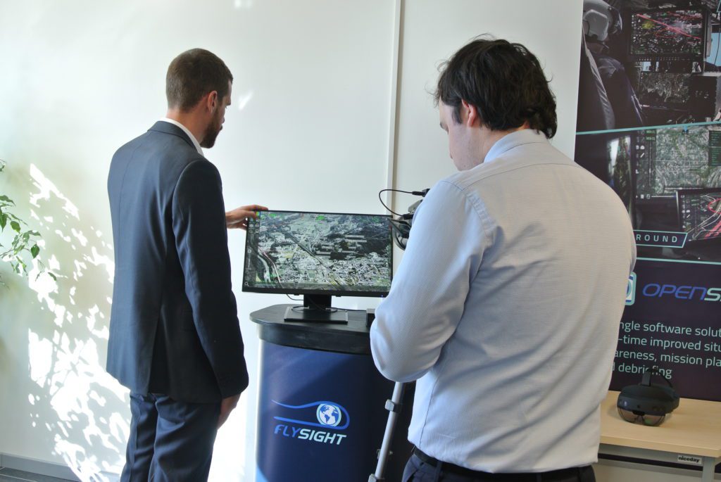
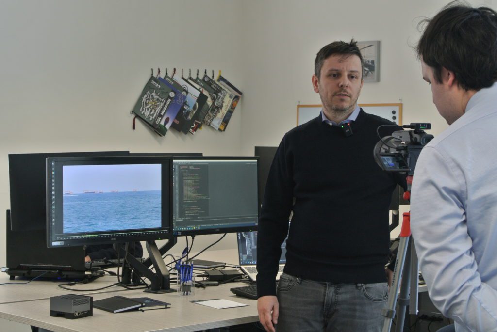
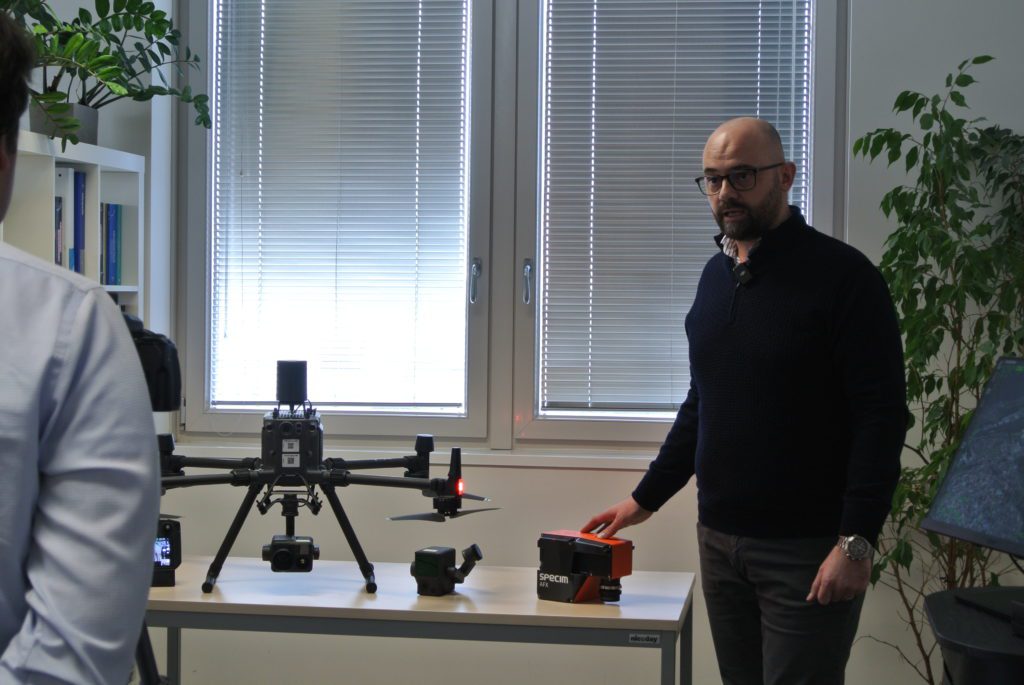
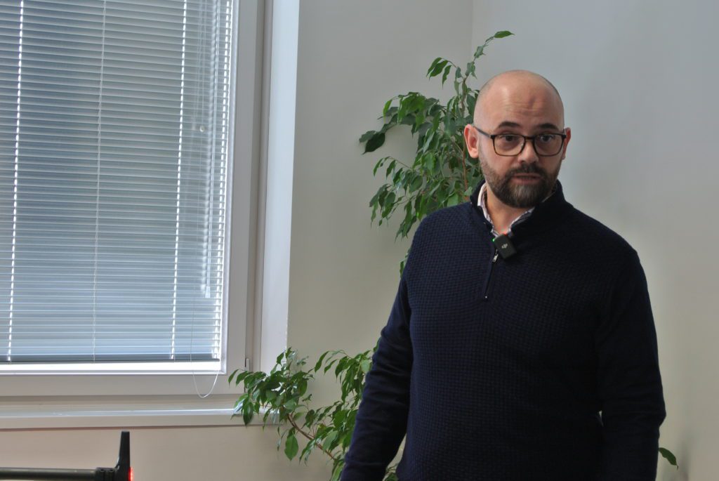
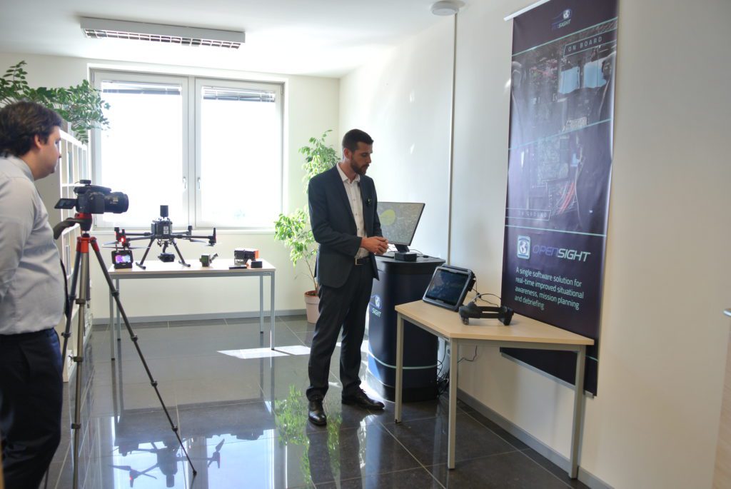
It has been shooting the first scene of the FlySight at SEAFUTURE 2023, yesterday morning at the FlySight headquarters office. Behind the camera was Giovanni Cavanna who arrived from the SEAFUTURE press office to interview our CTO Andrea Masini and three of our OPENSIGHT teams.

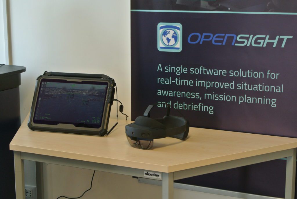
Andrea Masini introduced to the company and the capabilities of the solutions made in FlySight, able to offer an amazing situation awareness, which guarantees the operator an optimal making decision process in real-time in any mission-critical scenario. The focus of the interview was OPENSIGHT-uc (Underwater Optronic Mast Console), the turnkey solution for electro-optical data processing. Mattia Carpin, system engineer, Niccolò Camarlinghi, head of research and Giacomo Fontanelli, application specialist, have unveiled the details of the applications and the video processing capabilities with augmented reality functions and artificial intelligence support for electro-optical data exploitation.

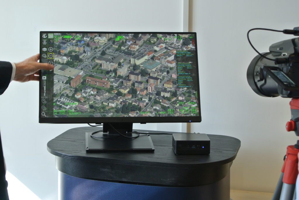
Important zoom on the main features of the product that will be showcased at the next SEAFUTURE, such as 3D coastline reconstruction and automatic target detection and classification (Artificial Intelligence networks specialized for maritime and airborne threats).

It is a good collaboration of the FlySight team for the SEAFUTURE 2023 show and soon we will see the frames collected in an original showcase video.

Discover if OPENSIGHT can meet your needs

Contact us now to have more information on a specific product.
We’ll get back as soon as we can.

Want to be always

up to date?

[/et_pb_column]
[/et_pb_row]
[/et_pb_column]

FlySight is proud to announce the official release of MAP CREATOR, a cutting-edge software tool developed to radically simplify and accelerate the preparation of map datasets for real-time 3D visualization.

Designed as a core component of the OPENSIGHT platform, MAP CREATOR allows users to transform raster, elevation, and vector data into optimized MBTILES — a standard format for tiled offline maps — with just a few clicks.

MAP CREATOR boasts a modern, intuitive Graphical User Interface (GUI) that eliminates the need for command-line skills or programming knowledge. Users can upload individual files or entire folders, preview content, apply smart styling rules, and generate ready-to-use map packages in record time. The tool supports a wide variety of geospatial formats, including TIFF, JPG, PNG, ECW, DTED (DT0, DT1, DT2), and shapefiles (.shp), ensuring flexibility across both commercial and defense applications.

What truly sets MAP CREATOR apart is its deep integration with OPENSIGHT Mission Console, making it not just a pre-processing tool but a strategic asset for mission planning and real-time operations.

Avionic Operators can now generate, preview, and load custom maps directly into the console environment — enhancing situational awareness and reducing reliance on external processing tools.

Among its standout features are:

⚙️ Smart vector styling with attribute-driven rules

⚙️ Support for terrain-aware vector rendering using elevation sources

⚙️ 3D extrusion and label rendering for intuitive map outputs

⚙️ High-performance raster and elevation tiling with multiprocessing support

⚙️ Advanced MBTILES merging to build seamless base layers and overlays

MAP CREATOR represents a major step forward in geospatial usability,” said Mattia Carpin, Head of Engineering at FlySight. “It combines the technical power of our SDK with the simplicity and visual control today’s users expect.

MAP CREATOR is now available as part of the latest OPENSIGHT SDK and with OPENSIGHT Mission Console. For demos, licensing, or partnership inquiries, contact FlySight’s commercial team.

FlySight team constantly develops cutting-edge solutions to provide real-time support in defence and security operations decision making.

Subscribe to our newsletter to be always updated with our latest innovations!

[/et_pb_section][/et_pb_column]
[/et_pb_row]
[/et_pb_column]

FlySight is proud to announce the official release of MAP CREATOR, a cutting-edge software tool developed to radically simplify and accelerate the preparation of map datasets for real-time 3D visualization.

Designed as a core component of the OPENSIGHT platform, MAP CREATOR allows users to transform raster, elevation, and vector data into optimized MBTILES — a standard format for tiled offline maps — with just a few clicks.

MAP CREATOR boasts a modern, intuitive Graphical User Interface (GUI) that eliminates the need for command-line skills or programming knowledge. Users can upload individual files or entire folders, preview content, apply smart styling rules, and generate ready-to-use map packages in record time. The tool supports a wide variety of geospatial formats, including TIFF, JPG, PNG, ECW, DTED (DT0, DT1, DT2), and shapefiles (.shp), ensuring flexibility across both commercial and defense applications.

What truly sets MAP CREATOR apart is its deep integration with OPENSIGHT Mission Console, making it not just a pre-processing tool but a strategic asset for mission planning and real-time operations.

Avionic Operators can now generate, preview, and load custom maps directly into the console environment — enhancing situational awareness and reducing reliance on external processing tools.

Among its standout features are:

⚙️ Smart vector styling with attribute-driven rules

⚙️ Support for terrain-aware vector rendering using elevation sources

⚙️ 3D extrusion and label rendering for intuitive map outputs

⚙️ High-performance raster and elevation tiling with multiprocessing support

⚙️ Advanced MBTILES merging to build seamless base layers and overlays

MAP CREATOR represents a major step forward in geospatial usability,” said Mattia Carpin, Head of Engineering at FlySight. “It combines the technical power of our SDK with the simplicity and visual control today’s users expect.

MAP CREATOR is now available as part of the latest OPENSIGHT SDK and with OPENSIGHT Mission Console. For demos, licensing, or partnership inquiries, contact FlySight’s commercial team.

FlySight team constantly develops cutting-edge solutions to provide real-time support in defence and security operations decision making.

Subscribe to our newsletter to be always updated with our latest innovations!

[/et_pb_section]