FlySight’s commitment to education and research: nurturing tomorrow’s innovators

Sep 29, 2023

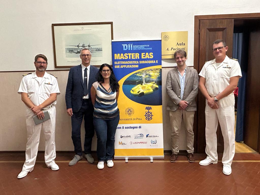
FlySight is proud to support the Master EAS UNIVERSITARIO DI II LIVELLO IN ELETTROACUSTICA SUBACQUEA E SUE APPLICAZIONI managed by the Dipartimento di Ingegneria dell’Informazione – Università di Pisa in collaboration with the Accademia Navale of Livorno Marina Militare. Recognizing the importance of nurturing talent and advancing knowledge in this domain, FlySight proudly supports the Master EAS. This collaboration signifies a significant step towards fostering innovation and expertise in underwater electroacoustics and its applications.

Unleashing Potential in Emerging Technologies

By supporting this program, FlySight underscores its deep belief in the importance of fostering connections with the world of education and research. The company recognizes that innovation thrives when knowledge and expertise are cultivated. By nurturing these ties with academia, FlySight aims not only to stay at the forefront of new technologies but also to contribute to the growth and development of innovation in the underwater domain.

During the presentation of the university course managed by the Dipartimento di Ingegneria dell’Informazione – Università di Pisa, in collaboration with the  Accademia Navale, it was emphasized that the Master EAS program holds relevance not only for the  Accademia Navale but also for the entire Italian Navy, as it plays a crucial role in shaping strategies for dominance in the underwater world. Furthermore, this master is fundamental within the framework of the new national hub for underwater activities, and involved three key ministries: Defense, Industry, and MIUR (Ministry of Education, Universities, and Research): such a testament to the shared commitment to advancing the field of underwater.

Nurturing innovation for the future

As technology continues to advance, the importance of programs like the Master EAS cannot be overstated. They not only prepare the next generation of experts but also shape strategies and contribute to the growth of knowledge and expertise in underwater eletroacoustics. 

The Elettroacustica Subacquea Master’s program covers a wide spectrum of underwater acoustics topics, preparing students and graduates for a dynamic industry. From generating and processing underwater electroacoustic signals to applications in environmental monitoring and subsea infrastructure, the program equips them with essential skills for tomorrow’s technologies. The common commitment highlights dedication to pushing advanced solutions and fostering a brighter future in the underwater technology.

From left to right: Alessandro Capecchi (Italian Navy), Emilio Simeone (FlySight), Anna Monreale (University of Pisa), Riccardo Costanzi (University of Pisa) and Maurizio Sonzogni (Italian Navy).
OPENSIGHT Augmented Reality System

Bringing superior capabilities to your optronic systems

Discover if OPENSIGHT can meet your needs

Contact us now to have more information on a specific product.
We’ll get back as soon as we can.

Want to be always

up to date?

[/et_pb_column]
[/et_pb_row]
[/et_pb_column]

FlySight is proud to announce the official release of MAP CREATOR, a cutting-edge software tool developed to radically simplify and accelerate the preparation of map datasets for real-time 3D visualization.

Designed as a core component of the OPENSIGHT platform, MAP CREATOR allows users to transform raster, elevation, and vector data into optimized MBTILES — a standard format for tiled offline maps — with just a few clicks.

MAP CREATOR boasts a modern, intuitive Graphical User Interface (GUI) that eliminates the need for command-line skills or programming knowledge. Users can upload individual files or entire folders, preview content, apply smart styling rules, and generate ready-to-use map packages in record time. The tool supports a wide variety of geospatial formats, including TIFF, JPG, PNG, ECW, DTED (DT0, DT1, DT2), and shapefiles (.shp), ensuring flexibility across both commercial and defense applications.

What truly sets MAP CREATOR apart is its deep integration with OPENSIGHT Mission Console, making it not just a pre-processing tool but a strategic asset for mission planning and real-time operations.

Avionic Operators can now generate, preview, and load custom maps directly into the console environment — enhancing situational awareness and reducing reliance on external processing tools.

Among its standout features are:

⚙️ Smart vector styling with attribute-driven rules

⚙️ Support for terrain-aware vector rendering using elevation sources

⚙️ 3D extrusion and label rendering for intuitive map outputs

⚙️ High-performance raster and elevation tiling with multiprocessing support

⚙️ Advanced MBTILES merging to build seamless base layers and overlays

MAP CREATOR represents a major step forward in geospatial usability,” said Mattia Carpin, Head of Engineering at FlySight. “It combines the technical power of our SDK with the simplicity and visual control today’s users expect.

MAP CREATOR is now available as part of the latest OPENSIGHT SDK and with OPENSIGHT Mission Console. For demos, licensing, or partnership inquiries, contact FlySight’s commercial team.

FlySight team constantly develops cutting-edge solutions to provide real-time support in defence and security operations decision making.

Subscribe to our newsletter to be always updated with our latest innovations!

[/et_pb_section][/et_pb_column]
[/et_pb_row]
[/et_pb_column]

FlySight is proud to announce the official release of MAP CREATOR, a cutting-edge software tool developed to radically simplify and accelerate the preparation of map datasets for real-time 3D visualization.

Designed as a core component of the OPENSIGHT platform, MAP CREATOR allows users to transform raster, elevation, and vector data into optimized MBTILES — a standard format for tiled offline maps — with just a few clicks.

MAP CREATOR boasts a modern, intuitive Graphical User Interface (GUI) that eliminates the need for command-line skills or programming knowledge. Users can upload individual files or entire folders, preview content, apply smart styling rules, and generate ready-to-use map packages in record time. The tool supports a wide variety of geospatial formats, including TIFF, JPG, PNG, ECW, DTED (DT0, DT1, DT2), and shapefiles (.shp), ensuring flexibility across both commercial and defense applications.

What truly sets MAP CREATOR apart is its deep integration with OPENSIGHT Mission Console, making it not just a pre-processing tool but a strategic asset for mission planning and real-time operations.

Avionic Operators can now generate, preview, and load custom maps directly into the console environment — enhancing situational awareness and reducing reliance on external processing tools.

Among its standout features are:

⚙️ Smart vector styling with attribute-driven rules

⚙️ Support for terrain-aware vector rendering using elevation sources

⚙️ 3D extrusion and label rendering for intuitive map outputs

⚙️ High-performance raster and elevation tiling with multiprocessing support

⚙️ Advanced MBTILES merging to build seamless base layers and overlays

MAP CREATOR represents a major step forward in geospatial usability,” said Mattia Carpin, Head of Engineering at FlySight. “It combines the technical power of our SDK with the simplicity and visual control today’s users expect.

MAP CREATOR is now available as part of the latest OPENSIGHT SDK and with OPENSIGHT Mission Console. For demos, licensing, or partnership inquiries, contact FlySight’s commercial team.

FlySight team constantly develops cutting-edge solutions to provide real-time support in defence and security operations decision making.

Subscribe to our newsletter to be always updated with our latest innovations!

[/et_pb_section]