Come to meet us @ Seafuture 2021

Aug 9, 2021

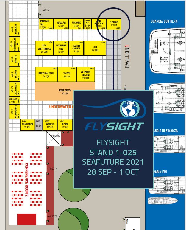
FlySight is pleased to announce that it will be exhibitor at SEAFUTURE 2021, after so many months away from in-presence events.

SEAFUTURE is in its 7th edition and it takes place in the La Spezia Naval Base, from 28th September to 1st October of this year. FlySight is happy to renew its presence at this world appointment with the see innovation.

MEET US in SEAFUTURE

The cutting-edge technologies developed in FlySight are also optimized for managing naval missions, manned and unmanned helicopters, in the maritime sector too.

OPENSIGHT-Underwater Optronic Mast Console is a FlySight turnkey solution for electro optical data processing in real-time. It provides special functions for data enhancing in a situational awareness environment designed for the underwater environment.

Discover if OPENSIGHT can meet your needs

Contact us now to have more information on a specific product.
We’ll get back as soon as we can.

Want to be always

up to date?

[/et_pb_column]
[/et_pb_row]
[/et_pb_column]

FlySight is proud to announce the official release of MAP CREATOR, a cutting-edge software tool developed to radically simplify and accelerate the preparation of map datasets for real-time 3D visualization.

Designed as a core component of the OPENSIGHT platform, MAP CREATOR allows users to transform raster, elevation, and vector data into optimized MBTILES — a standard format for tiled offline maps — with just a few clicks.

MAP CREATOR boasts a modern, intuitive Graphical User Interface (GUI) that eliminates the need for command-line skills or programming knowledge. Users can upload individual files or entire folders, preview content, apply smart styling rules, and generate ready-to-use map packages in record time. The tool supports a wide variety of geospatial formats, including TIFF, JPG, PNG, ECW, DTED (DT0, DT1, DT2), and shapefiles (.shp), ensuring flexibility across both commercial and defense applications.

What truly sets MAP CREATOR apart is its deep integration with OPENSIGHT Mission Console, making it not just a pre-processing tool but a strategic asset for mission planning and real-time operations.

Avionic Operators can now generate, preview, and load custom maps directly into the console environment — enhancing situational awareness and reducing reliance on external processing tools.

Among its standout features are:

⚙️ Smart vector styling with attribute-driven rules

⚙️ Support for terrain-aware vector rendering using elevation sources

⚙️ 3D extrusion and label rendering for intuitive map outputs

⚙️ High-performance raster and elevation tiling with multiprocessing support

⚙️ Advanced MBTILES merging to build seamless base layers and overlays

MAP CREATOR represents a major step forward in geospatial usability,” said Mattia Carpin, Head of Engineering at FlySight. “It combines the technical power of our SDK with the simplicity and visual control today’s users expect.

MAP CREATOR is now available as part of the latest OPENSIGHT SDK and with OPENSIGHT Mission Console. For demos, licensing, or partnership inquiries, contact FlySight’s commercial team.

FlySight team constantly develops cutting-edge solutions to provide real-time support in defence and security operations decision making.

Subscribe to our newsletter to be always updated with our latest innovations!

[/et_pb_section][/et_pb_column]
[/et_pb_row]
[/et_pb_column]

FlySight is proud to announce the official release of MAP CREATOR, a cutting-edge software tool developed to radically simplify and accelerate the preparation of map datasets for real-time 3D visualization.

Designed as a core component of the OPENSIGHT platform, MAP CREATOR allows users to transform raster, elevation, and vector data into optimized MBTILES — a standard format for tiled offline maps — with just a few clicks.

MAP CREATOR boasts a modern, intuitive Graphical User Interface (GUI) that eliminates the need for command-line skills or programming knowledge. Users can upload individual files or entire folders, preview content, apply smart styling rules, and generate ready-to-use map packages in record time. The tool supports a wide variety of geospatial formats, including TIFF, JPG, PNG, ECW, DTED (DT0, DT1, DT2), and shapefiles (.shp), ensuring flexibility across both commercial and defense applications.

What truly sets MAP CREATOR apart is its deep integration with OPENSIGHT Mission Console, making it not just a pre-processing tool but a strategic asset for mission planning and real-time operations.

Avionic Operators can now generate, preview, and load custom maps directly into the console environment — enhancing situational awareness and reducing reliance on external processing tools.

Among its standout features are:

⚙️ Smart vector styling with attribute-driven rules

⚙️ Support for terrain-aware vector rendering using elevation sources

⚙️ 3D extrusion and label rendering for intuitive map outputs

⚙️ High-performance raster and elevation tiling with multiprocessing support

⚙️ Advanced MBTILES merging to build seamless base layers and overlays

MAP CREATOR represents a major step forward in geospatial usability,” said Mattia Carpin, Head of Engineering at FlySight. “It combines the technical power of our SDK with the simplicity and visual control today’s users expect.

MAP CREATOR is now available as part of the latest OPENSIGHT SDK and with OPENSIGHT Mission Console. For demos, licensing, or partnership inquiries, contact FlySight’s commercial team.

FlySight team constantly develops cutting-edge solutions to provide real-time support in defence and security operations decision making.

Subscribe to our newsletter to be always updated with our latest innovations!

[/et_pb_section]