FlySight Returns as Conference Sponsor for European Rotors 2023 in Madrid

Aug 28, 2023

🚁Flysight is thrilled to announce its participation in the upcoming European Rotors event to take place in Madrid at the end of November. Building upon the success of last year’s engagement, Flysight is honored to return as a conference sponsor and exhibitor, with a renewed commitment to advancing the field of avionics.

The European Helicopter Association (EHA) and the European Union Aviation Safety Agency (EASA) have teamed this year again up to create an exceptional showcase for the European VTOL branch.

European Rotors stands as a global professional networking for aviation enthusiasts, industry professionals, and innovators to convene and explore the latest breakthroughs in the aviation sector. With Flysight’s presence also this year, the event is poised to deliver an even more impactful experience.

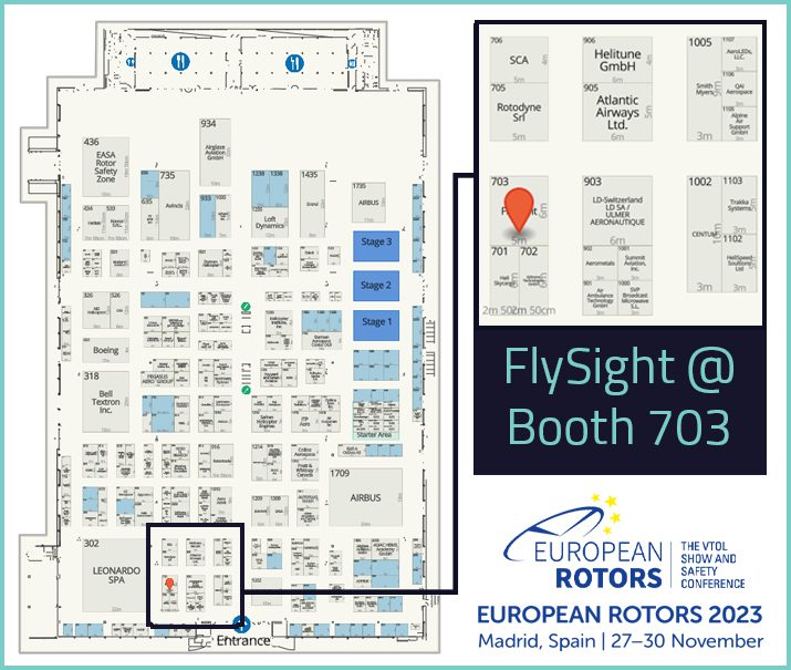
Last year’s presence at European Rotors provided Flysight with a perfect venue to showcase its cutting-edge avionics OPENSIGHT solutions and establish connections with key industry players. Given the overwhelmingly positive response received during the event, the decision to once again sponsor the conference and exhibit at booth #703 this year was a natural progression.


With a thriving community of avionics experts and enthusiasts, European Rotors offers on time again an invaluable opportunity for Flysight to engage in meaningful interactions, share insights, and collaborate on the future of aviation technology. By participating as a conference sponsor and exhibitor, Flysight aims to foster dynamic discussions, facilitate knowledge exchange, and further its mission of maximise the situation awareness of the airborne operator, empowering OPENSIGHT capabilities.

At EUROPEAN ROTORS we meet innovations and technologies of the evolution of vertical flight, share possible solutions and proposals with the Rotorcraft community- said FlySight CEO Andrea Masini in the event guide-. Our OPENSIGHT is proving to be the flywheel for the success of new mission consoles, thanks to its best-in-class features for a real cognitive enhancement. After our first presence in 2022 we have increased our collaborations, expanded our perspectives and ideas for the future, concretizing success stories, which we will bring in Madrid. 

The company warmly invites all attendees to visit their booth, where they will have the unique opportunity to experience firsthand Flysight’s state-of-the-art OPENSIGHT solutions, engage in insightful dialogues with the Flysight team, or also just to chat and drink a coffee and take a look into the latest updates in OPENSIGHT skills and integrations.

▶ Click and peek some frames of euroepan rotors 2022 edition and

👀watch again our in-depth with FlySight Head of engineering Mattia Carpin at #europeanrotors22 on FlySight Vimeo channel

Discover if OPENSIGHT can meet your needs

Contact us now to have more information on a specific product.
We’ll get back as soon as we can.

Want to be always

up to date?

[/et_pb_column]
[/et_pb_row]
[/et_pb_column]

FlySight is proud to announce the official release of MAP CREATOR, a cutting-edge software tool developed to radically simplify and accelerate the preparation of map datasets for real-time 3D visualization.

Designed as a core component of the OPENSIGHT platform, MAP CREATOR allows users to transform raster, elevation, and vector data into optimized MBTILES — a standard format for tiled offline maps — with just a few clicks.

MAP CREATOR boasts a modern, intuitive Graphical User Interface (GUI) that eliminates the need for command-line skills or programming knowledge. Users can upload individual files or entire folders, preview content, apply smart styling rules, and generate ready-to-use map packages in record time. The tool supports a wide variety of geospatial formats, including TIFF, JPG, PNG, ECW, DTED (DT0, DT1, DT2), and shapefiles (.shp), ensuring flexibility across both commercial and defense applications.

What truly sets MAP CREATOR apart is its deep integration with OPENSIGHT Mission Console, making it not just a pre-processing tool but a strategic asset for mission planning and real-time operations.

Avionic Operators can now generate, preview, and load custom maps directly into the console environment — enhancing situational awareness and reducing reliance on external processing tools.

Among its standout features are:

⚙️ Smart vector styling with attribute-driven rules

⚙️ Support for terrain-aware vector rendering using elevation sources

⚙️ 3D extrusion and label rendering for intuitive map outputs

⚙️ High-performance raster and elevation tiling with multiprocessing support

⚙️ Advanced MBTILES merging to build seamless base layers and overlays

MAP CREATOR represents a major step forward in geospatial usability,” said Mattia Carpin, Head of Engineering at FlySight. “It combines the technical power of our SDK with the simplicity and visual control today’s users expect.

MAP CREATOR is now available as part of the latest OPENSIGHT SDK and with OPENSIGHT Mission Console. For demos, licensing, or partnership inquiries, contact FlySight’s commercial team.

FlySight team constantly develops cutting-edge solutions to provide real-time support in defence and security operations decision making.

Subscribe to our newsletter to be always updated with our latest innovations!

[/et_pb_section][/et_pb_column]
[/et_pb_row]
[/et_pb_column]

FlySight is proud to announce the official release of MAP CREATOR, a cutting-edge software tool developed to radically simplify and accelerate the preparation of map datasets for real-time 3D visualization.

Designed as a core component of the OPENSIGHT platform, MAP CREATOR allows users to transform raster, elevation, and vector data into optimized MBTILES — a standard format for tiled offline maps — with just a few clicks.

MAP CREATOR boasts a modern, intuitive Graphical User Interface (GUI) that eliminates the need for command-line skills or programming knowledge. Users can upload individual files or entire folders, preview content, apply smart styling rules, and generate ready-to-use map packages in record time. The tool supports a wide variety of geospatial formats, including TIFF, JPG, PNG, ECW, DTED (DT0, DT1, DT2), and shapefiles (.shp), ensuring flexibility across both commercial and defense applications.

What truly sets MAP CREATOR apart is its deep integration with OPENSIGHT Mission Console, making it not just a pre-processing tool but a strategic asset for mission planning and real-time operations.

Avionic Operators can now generate, preview, and load custom maps directly into the console environment — enhancing situational awareness and reducing reliance on external processing tools.

Among its standout features are:

⚙️ Smart vector styling with attribute-driven rules

⚙️ Support for terrain-aware vector rendering using elevation sources

⚙️ 3D extrusion and label rendering for intuitive map outputs

⚙️ High-performance raster and elevation tiling with multiprocessing support

⚙️ Advanced MBTILES merging to build seamless base layers and overlays

MAP CREATOR represents a major step forward in geospatial usability,” said Mattia Carpin, Head of Engineering at FlySight. “It combines the technical power of our SDK with the simplicity and visual control today’s users expect.

MAP CREATOR is now available as part of the latest OPENSIGHT SDK and with OPENSIGHT Mission Console. For demos, licensing, or partnership inquiries, contact FlySight’s commercial team.

FlySight team constantly develops cutting-edge solutions to provide real-time support in defence and security operations decision making.

Subscribe to our newsletter to be always updated with our latest innovations!

[/et_pb_section]