Terrain Awareness and Warning Systems (TAWS – or HTAWS when specifically talking about helicopters) are one of the most critical safety components for helicopters. These specialised systems are designed to perform one vital function: prevent Controlled Flight Into Terrain (CFIT) incidents, one of the most lethal and feared types of rotary-wing accidents. Using the helicopter’s onboard geospatial system, HTAWS provides pilots with an accurate position relative to terrain and issues both visual and audible alerts when a terrain or obstacle collision risk is detected.
In this article, we’ll look in more detail at how HTAWS in helicopters works, the different types of alerts, and how HTAWS can do much more than simply prevent devastating crashes. We’ll look at how HTAWS can be integrated into a modern console and the importance of terrain awareness in general, both for safety and to ensure mission success in challenging environments. We’ll also examine current HTAWS regulations and show you how this vital piece of equipment works in the real world, as well as how other technologies, such as FlySight’s groundbreaking OPENSIGHT Mission Console, can help improve helicopter safety.
What is TAWS, and why is it critical in helicopter aviation?
TAWS is used across the aviation industry, but due to the unique nature of rotary-wing aircraft such as helicopters, a more specialised version is required. Helicopter Terrain Awareness and Warning Systems are designed to prevent helicopters from impacting the terrain, known as Controlled Flight Into Terrain incidents.
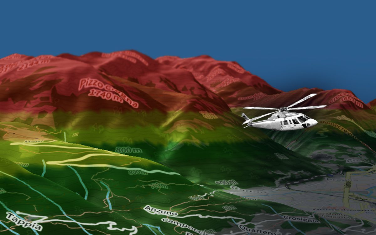
Using the helicopter’s onboard GPS-derived position, flight path, altitude, and other data, HTAWS continually monitors and compares the vehicle’s location against terrain and obstacle databases. If a collision risk is detected, the system immediately issues alerts on the dashboard or head-up display, as well as a loud aural alert so that the pilot can take emergency evasive action.
We consistently talk about situational awareness when flying helicopters. HTAWS plays a key role not only in the aircraft’s inherent safety but also in enabling operators to improve their situational awareness, particularly in poor conditions such as haze and fog, and during night flights.
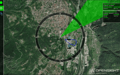
The way HTAWS in helicopters integrates terrain data already accessible in mission consoles like OPENSIGHT means that pilots have better, more accurate information to work with and a far greater degree of situational and spatial awareness.
How TAWS works
- Terrain Awareness and Warning Systems use sophisticated sensors and terrain databases, along with real-time GPS positioning, to determine the exact location of an aircraft relative to terrain and potential obstacles and hazards in the immediate area and along the unit’s predicted flight path.
- Terrain databases – This key component of TAWS is a comprehensive, up-to-date database that includes elevation data, terrain type (e.g., mountainous or urban), and any additional Enhanced Reality overlays that can provide relevant information. This can include the heights of buildings, the positions of power lines, and any restricted airspace, such as around airports or military installations.
- Predictive algorithms – A terrain database is simply a stored ‘map’ of the location. Using predictive algorithms enables HTAWS to utilise this information by predicting the unit’s path within that terrain in real time. If it senses a potential collision point, it triggers the alarm system to alert the pilot and crew.
- Aircraft location or position – Normally determined using the vehicle’s GPS and other navigational inputs. The GPS data accurately tells the TAWS system the aircraft’s current location, including its altitude (crucial for determining proximity to terrain and other hazards) and trajectory.
Different types of TAWS alerts
Having an alert system is useless unless you can distinguish what kind of hazard you are dealing with. This will determine the course of action the pilot takes and the level of urgency. HTAWS in helicopters has different types of alerts for various situations, including:
- Forward-Looking Terrain Avoidance (FLTA) – Think of this as the pilot’s ‘early warning’ system, giving the operator advanced warning on potential threats posed by undulations or changes in the terrain and obstacles that could be a significant threat to the aircraft, such as high buildings or power lines. FLTA uses a combination of all three key elements of TAWS, in particular, terrain databases such as maps. These can be enhanced by integrating mission console plug-ins, such as dehazing software, which can give the pilot a clearer view of the terrain even in hazy conditions.
- Premature Descent Alerts (PDA) – One of the most frightening and hazardous situations a pilot can face is a premature or sudden descent. PDA alerts pilots when the aircraft descends below a defined approach path or too early in relation to the intended landing area. The early warning system allows pilots to immediately adjust the descent rate to a more controlled and safer level.
- Excessive Closure Rate (ECR) – The closure rate (how quickly the aircraft is approaching terrain) may be too rapid, requiring the pilot to adjust the aircraft’s direction or speed. An ECR alarm alerts the pilot to their situation, giving them more time to respond.
Regulatory compliance of TAWS in helicopters
Surprisingly, HTAWS in helicopters is not always mandatory and varies from region to region. In the US, FAA regulations mandate HTAWS for helicopter air ambulance operations under Part 135. In Europe and the UK, offshore commercial air transport operations are covered by EASA guidance and the UK CAA standards such as CAP1519.
Regulators continue to review HTAW requirements, but mandates remain focused on specific higher risk. While terrain awareness and warning systems are not considered commercially viable for smaller helicopters, the positive role of HTAWS in helicopter safety is indisputable.
TAWS in action
HTAWS in helicopters is far more than just a safety net for the pilot. When integrated with mission consoles and synthetic/enhanced vision systems, HTAWS can do much more than simply alert the pilot to potential dangers. TAWS can bring together key elements of a mission console, creating a more ‘joined up’ mission procedure, especially in challenging terrain.
That makes TAWS particularly useful in poor weather conditions, when flying in mountainous or challenging terrain, and for improving pilots’ situational awareness during night flights. For commercial flights, knowing that the aircraft is equipped with TAWS provides passengers with additional reassurance about its safety.
The challenges facing HTAWS in helicopters
While TAWS seems like a ‘no-brainer’, there are challenges that can prevent its inclusion in a mission console. Firstly, integrating HTAWS with legacy systems isn’t always easy. Calibration can be particularly difficult, so extensive testing is needed to ensure the two systems mesh.
Secondly, the accuracy of the databases used by TAWS needs to be continually assessed, with regular updates to identify any changes in terrain or the addition of new hazards, particularly in urban environments.
Thirdly, technological advances may lead to enhancements, but once again, these must be integrated with legacy systems. Improved algorithms can help tighten any gaps in the safety net and integrating TAWS into augmented and AI systems should be done on a case-by-case basis rather than a generic approach. This can, in turn, drive up the cost of incorporating TAWS into aircraft that are not necessarily mandated to have it installed under any regulatory obligations.
The future of helicopter terrain awareness – FlySight’s OPENSIGHT leads the way
Where next for HTAWS in helicopters? Emerging technologies, such as synthetic vision systems and more complex sensors like LiDAR, mean that TAWS accuracy can only improve. In urban environments, the use of improved obstacle databases for temporary structures such as construction cranes is also crucial. Fortunately, the advent of AI and Enhanced Reality mapping makes that far easier to implement.
The FlySight OPENSIGHT Mission Console platform has been specifically designed for its interoperability with helicopter aviation systems, including HTAWS. With improved situational awareness at its core, OPENSIGHT enables operators to create bespoke systems tailored to exact requirements and mission needs, whether for military, law enforcement, SAR, or civilian operations.
A prime example of this in operation is the FlySight Fog Suppression System. Using a 25 frames per second configuration in QVGA and a 20% visibility enhancement, it can cut through fog and hazy conditions, helping improve the visibility of terrain and associated hazards.
You can find out more about OPENSIGHT by browsing our dedicated Mission Console page, as well as our informative videos and brochure library. Alternatively, you can contact us directly to find out more about OPENSIGHT’s helicopter technologies for civilian and military use. Call us today.