

An interoperable mission ecosystem for complex operations
Airborne missions bring together advanced sensors, platforms, data sources, communication systems, and mission applications.
The challenge is no longer simply to acquire data. It is to make the entire mission system work together.
With Mission Suite operators can:
- Integrate advanced sensor and capabilities (including Radar and other mission sensors), to support increasingly complex operational scenarios.
- Manage mission data as a structured information asset, from live sensor data and tracks to sources such as AIS, creating a persistent mission database that can be correlated, searched and used throughout the mission lifecycle. AIS becomes more than a live data feed: Mission Suite can structure and retain AIS information as part of the mission database, making it available for correlation, analysis and post-mission review.
- Export mission data for post-mission analysis and debriefing, including interoperability with external debriefing and analysis systems.
PART OF THE SUITE
From sensor data to an integrated mission capability.
Situational awareness is only one layer of the mission.
OPENSIGHT Mission System extends beyond the operational display to address the broader mission ecosystem:

It provides the framework to integrate heterogeneous capabilities, manage mission information, exchange data and validate end-to-end operational workflows.
The result is a common operational environment where information from different systems can be brought together, correlated and used as part of the same mission.
One ecosystem. One mission.
Designed for interoperability from the ground up.
Mission systems are increasingly built from heterogeneous technologies.
Different sensors.
Different manufacturers.
Different protocols.
Different data formats.
Different mission applications.
OPENSIGHT is designed to bring these elements together within a modular and interoperable architecture.
Connect
Integrate sensors, payloads, external systems and data sources through standardized and vendor-specific interfaces.
Understand
Combine video, tracks, metadata, geospatial information and mission objects within a common operational environment.
Exchange
Import and export mission data and exchange information between distributed consoles and external systems.
Operate
Give operators a coherent environment for situational awareness, mission data management and sensor control.
Validate
Verify that integrated systems, data flows, interfaces and operational workflows work correctly as part of the complete mission.
Analyse
Capture mission information for replay, post-mission analysis, debriefing and reporting.
Mission Execution
Plan. Simulate. Replay. Validate
A system can exchange data and still fail to deliver the expected operational capability.
The data must be correctly interpreted.
Metadata must remain consistent.
Tracks must be correctly correlated.
Commands must reach the intended system.
Sensor information must be available where and when the operator needs it.
And the complete workflow must perform as expected.
OPENSIGHT connects integration with operational validation. This means moving beyond individual interface testing to verify the complete operational chain.
System
Can the systems communicate?
DATA
Is the information correctly exchanged and interpreted?
Integration
Do the different capabilities work together?
Operation
Can the operator effectively use the integrated capability?
VALIDATION
Does the complete mission workflow perform as expected?
Mission System Integration
Operational Intelligence Across Platforms
OPENSIGHT brings together information generated by multiple systems and sensors into a structured mission environment.
Mission information can be visualized, managed, exchanged and archived throughout the mission lifecycle.
OPENSIGHT Mission Console already provides structured mission data management, including mission objects, external sensor data, mission archives and post-mission analysis capabilities.
Mission data can include:
- Live and recorded video
- Sensor metadata
- Platform telemetry
- Mission objects
- External tracks
- AIS contacts
- ADS-B data
- Tactical data
- Geospatial information
- Target detections and classifications
- Operator inputs and mission events
Interoperability by design
Built to connect different systems
OPENSIGHT supports an expanding set of interfaces and integration capabilities.
Standard / Protocol |
Data / Function |
Purpose |
|---|---|---|
| STANAG 4586 | Sensor control and cueing | Interfaces supporting sensor control and unmanned system integration. |
| STANAG 4609 | Live video transport | Transport and integration of motion imagery within the mission environment. |
| STANAG 4607 | GMTI radar data | Integration of ground moving target information. |
| STANAG 7023 | NITF radar imagery | Mission integration of imagery and associated metadata. |
| Cursor-on-Target (CoT) | Tactical and tracking data exchange | Structured exchange of tactical and tracking information. |
| AIS | Maritime traffic information | Maritime traffic information integrated into the common operational picture. |
The architecture is modular, allowing additional capabilities to be integrated according to mission and customer requirements.
Interoperability is not an add-on. It is part of the architecture.
OPENSIGHT Mission Suites
A growing ecosystem of mission capabilities
Individual capabilities operate within one common mission environment and interact.

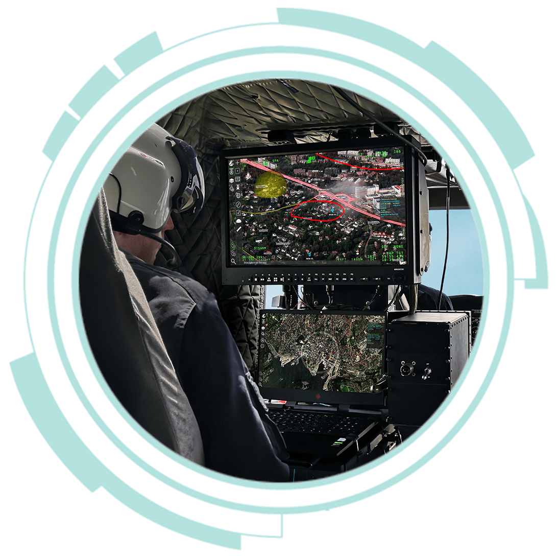
Mission Console
The operational interface for situational awareness and mission management.
Mission Console combines geospatial information, live sensor video, mission data and sensor control within a single operational environment.
It provides the current operational foundation of the OPENSIGHT Mission System family.
MISSION SUITE CAPABILITIES
Radar
Bring radar-derived information into the common mission environment.
Radar data can be integrated and represented as geospatial information, allowing radar-derived tracks and information to become part of the wider operational picture.
ATR
Transform sensor video into actionable mission data.
Automatic Target Recognition enables AI-based detection and classification of predefined targets within live video, with detections georeferenced and displayed within the operational environment.
Mission Console already supports ATR integration, including real-time detection, classification and georeferencing.
Tracking & Mission Data
Manage and correlate information from multiple sources.
OPENSIGHT supports the management and visualization of external tracks and mission objects, creating a common information layer across the mission.
Mission data can include AIS contacts, ADS-B aircraft tracks, CoT tracks, remote system objects and user-generated mission objects.
From Integration to Operation
OPENSIGHT Mission Suite follows the complete mission lifecycle.

INTEGRATION
Connect sensors, systems, protocols and data sources.

CONFIGURATION
Configure mission capabilities and operational workflows.

VALIDATION
Verify interfaces, data flows and end-to-end operational behaviour.

OPERATION
Execute the mission through a common operational environment.

DATA MANAGEMENT
Capture, exchange and structure mission information.

POST-MISSION
Replay, analyse, report and improve.
One ecosystem across the mission lifecycle.
Mission Domains
One ecosystem. Multiple operational scenarios.
OPENSIGHT Mission System can support different operational scenarios through a common interoperable architecture.
Application Area |
Capabilities / Information |
|---|---|
| ISR / ISTAR | Sensor integration, geospatial awareness, video, tracking, mission data and target information. |
| Maritime Surveillance | AIS, radar, video, geospatial data and vessel tracking within a common operational picture. |
| Tactical Missions | Tactical symbology, tracks, sensor information, mission objects and external systems. |
| Command & Control | Exchange structured mission information across distributed operational environments. |
| Unmanned Systems | Extend mission capabilities across remotely operated and autonomous platforms. |
| Search & Rescue | Geospatial information, sensor video, tracking and external location data for coordinated search operations. |
Want to know more about OPENSIGHT?
Designed and developed to meet specific needs in any scenario, OPENSIGHT is a multi-platform PED (Processing, Exploitation and Dissemination) system created to provide the best support in decision making.
Contact us, our team is here to help!
