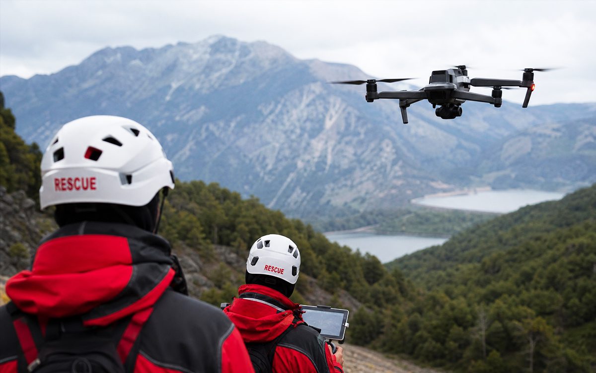
Search and rescue drones, also referred to as SAR drones, are highly effective in search‑and‑rescue missions when used with the right sensors, protocols, and trained operators. They are credited with reducing search times, expanding the coverage of a search operation, especially in difficult mountainous terrain, and improving situational awareness.
The effectiveness of rescue drones does, however, vary, depending on training, autonomy level, and environmental conditions. Advanced drone technology includes multi-spectral sensors, integrated AI and Enhanced Reality, and automatic target recognition.
In this article, we’ll take a more in-depth look at the use of search and rescue drones and how SAR missions can be enhanced by their use. We’ll examine the history of SAR missions and the reliance on both traditional methods and the integration of drone technology, as well as looking at the latest technology available to SAR teams. We’ll also discuss how the latest UAV search and rescue drones can be paired with AI and surveillance technology to improve SAR mission success rates.
A brief history of SAR missions and the reliance on traditional methods
Traditional SAR relied on human observation, physical endurance, and simple mechanical tools. Communications were often limited for early rescue teams; it wasn’t until the 20th Century that aerial support became a common feature of SAR missions. This made missions slow, dangerous, and geographically limited, and coordinating a successful mission far more challenging, especially in mountainous or extremely hostile terrain.
In the 20th century, SAR missions both on land and at sea were vastly improved by the introduction of the use of aerial support, particularly helicopters. As time went on, the plethora of sensor technology employed in the military and law enforcement sectors found a natural fit in SAR, including infrared and heat detection sensors. The transformation from traditional localised SAR to a far more coordinated approach that could include multi-agency operations also considerably improved the chances of finding survivors alive.
How advanced new technologies are impacting SAR mission success rates
Today, new technologies such as automatic target recognition and other AI and sensor-driven tech are pushing the effectiveness of search and rescue to new levels. The introduction of SAR drones in particular is a major step forward in aerial SAR missions. As drones rapidly advance in both effectiveness and the ability to stay in the air longer, UAV SAR missions are becoming a more integrated part of comprehensive SAR planning.
Advanced technologies can improve the likelihood of successful outcomes for SAR missions, through key elements such as detection accuracy and safety standards for both survivors and SAR teams. Performance metrics like target localisation time and the POS (probability of success) rate are improved through greater search efficiency and, crucially, better communications. These improvements, especially when associated with technology such as UAV SAR drones, greatly increase search efficiency, which, in turn, improves the mission success rate of SAR operations.
A deep dive into the latest SAR drone technology
Much of the technology already integrated into military and law enforcement aerial platforms naturally translates to search and rescue mission requirements. New and innovative systems such as FlySight’s OPENSIGHT Mission Console are just as applicable to SAR missions as they are to crowd control, active surveillance in combat zones, and more. These consoles are not one stand-alone system, but are made up of integrated turnkey solutions that all work towards improving mission success, whether that’s following a target vehicle or finding a lost hiker in mountainous terrain. Let’s take a closer look at the current features and how they work within a SAR context.
- Thermal Imaging Cameras – Thermal imaging cameras have been around for a while. The introduction of multi-spectral sensors makes them far more sensitive than earlier versions. Their use in identifying ‘hot spots’ that can indicate body heat makes them invaluable in SAR missions, and the miniaturisation of cameras in recent years without the loss of image quality means they can be incorporated into drones as well as larger aerial platforms.
- AI and object detection – AI models can be used to analyse multi-spectral data, including thermal imaging, visual, and radar or LiDAR, to identify people, vehicles, life rafts (at sea) and debris fields that can pinpoint a crash in mountainous terrain. They achieve this using deep learning processing as well as data analysis of a far greater amount of input than is possible by human analysts alone. The key takeaway from AI and object detection is the speed at which this can be done, which can have a huge impact on the positive outcome of a mission.
- GPS and autonomous navigation – Linking up to satellites and other navigational tools, UAV search and rescue drones can operate semi-autonomously of human rescue teams, feeding vital information and helping to direct ground teams to a location more quickly.
- Real-time video streaming – Because much of the modern SAR mission technology is interlinked, large amounts of data, including real-time video, can be quickly gathered, analysed, and interpreted faster. Again, the quicker response time and the ability for AI to filter out ‘background noise’ that could muddy the data immediately make it more likely that a SAR operation will have a successful outcome.
- LiDAR and 3D Mapping –These give rescuers an accurate, real‑time understanding of the environment and greater situational awareness by creating high-resolution, 3D models of the environment. This works particularly well when visual blockages, including forests, collapsed buildings, or hazy conditions, obscure the ground.
- Obstacle avoidance systems – These can help prevent drone collisions with obstacles such as trees, power lines and structures.
Pairing drones with AI and surveillance technology
Drones with greater payload capacity and longer endurance are becoming invaluable tools in SAR missions. Whether operating a single drone or more complex drone ‘swarms’, SAR mission commanders now have the option of fitting a plethora of surveillance technology that gives them effective ‘eyes in the sky’. These include:
Wide-Area Motion Imagery (WAMI) – Used by the military for years, WAMI sensors are exceptionally lightweight, making them ideal for drone use. An extended view of the terrain gives operators a better chance of spotting indicators that could help to narrow a search area, such as debris.
Search and Rescue Satellite-Aided Tracking (SARSAT) – COSPAS-SARSAT was first developed in the late 70s, with the first satellite launches in 1982. It was immediately obvious how beneficial it could be to SAR missions. Using GPS satellites, it can identify distress beacons faster and more accurately, and, because it’s a satellite-aided system, it can operate anywhere in the world. OPENSIGHT data gathered from a range of sensory inputs can be analysed in real-time and form the basis of more successful search operations, even in the most challenging terrain.
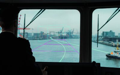
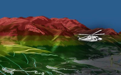
AI and AR technology – We have repeatedly mentioned the correlation of AI and AR technology for search and rescue applications, but it is worth reiterating its importance once again. AI algorithms work in all types of applications, from target detection to image clarity. Introduce the additional factor of augmented reality with overlay maps and external data sources, and you can create dynamic geospatial visualisations that increase situational awareness without creating sensory overload and fatigue in the operator. You can read more about how OPENSIGHT is contributing to this important area by reading our article on SAR technology of the future and target recovery.
How SAR drone technology can benefit SAR operators
Search and rescue drone technology can greatly expand the options that SAR operators have by supporting existing aerial and ground teams. For missing person searches, SAR drones, especially those linked to a swarm system, can cover far greater areas in a shorter time, raising the possibility of a successful rescue mission.
In disaster response, the use of wide-angle visual technology can give first responders a much faster initial analysis of the disaster zone, identifying hot spots in the case of fires and even detecting heat signatures of survivors through the use of thermal imaging.
But where drones really come into their own is in disaster emergency responses in hazardous or difficult terrain, such as at sea, in mountainous areas, or even in urban locations that have been destroyed by flooding, fire, or earthquakes. In this latter scenario, systems such as OPENSIGHT can overlay AR maps detailing the original layout of the terrain with real-time visual data that can help teams orientate themselves and form more effective search patterns.
The potential uses of SAR drone technology are far-reaching. They can include flood and wildfire response, maritime search and rescue, coastguard and naval rescues, urban emergency response, and even military personnel recovery from hostile zones.
Advanced SAR drones compare favourably to traditional search and rescue methods in that they are cheaper, do not put rescue teams at immediate risk, and are an efficient use of both human and mechanical resources. They cost less to put in the air than a helicopter, and in a swarm can cover large areas efficiently. Increased payloads allow them to carry more sensors, all of which can lead to faster, more effective SAR responses, even at night. While SAR drones will never fully replace human teams, they work as a highly effective tool that can certainly enhance the success rate of SAR missions.
The future of SAR drone technology – How OPENSIGHT is leading the way
The most likely way SAR drones could evolve over the coming years is through increased airtime enabled by better battery technology. This would give search and rescue drones longer flight times and greater distance capabilities.
Using AI-assisted search automation, drone swarms will become common and a more practical method of covering a large area. AI-assisted search automation will support wider adoption of Beyond Visual Line of Sight (BVLOS) operations, incorporating the same kind of technology already used by military drones.
At the forefront of all this, FlySight’s OPENSIGHT platform for search and rescue is shaping the future of AI and AR-assisted SAR drones. OPENSIGHT’s mission consoles are customisable to suit the operator’s specific requirements, allowing them to include key elements such as dehazing and target recognition technology in a search and rescue platform. Using software that can be incorporated into many legacy systems, the compact nature and high resolution of OPENSIGHT’s individual elements make it a clear and practical choice for SAR missions.
You can find out more by visiting our OPENSIGHT Solution Page or by contacting our team and discussing your specific needs in detail.