Airborne Search and Rescue (SAR) units are life-savers for thousands of stranded people every year. Search and rescue technology has come a long way in the last 30 years, with the advent of search and rescue equipment that allows responders to find and rescue individuals more quickly and accurately than ever before.
Speed and accuracy of rescue is the most important concern for both airborne and ground units. The longer it takes to locate and retrieve a victim, the less likely they are to survive, especially in hostile conditions such as at sea, in mountainous terrain or at the scene of a disaster like an earthquake, tsunami or war zone. New technology is improving search and rescue mission responses and target location rates.
In this article, we’ll take a look at some of the most important new developments available to both civilian and military SAR airborne teams, the benefits of using this search and rescue technology, and how systems such as augmented reality and multi-spectral sensors could advance the success rates of SAR units around the world. We’ll also give you a brief overview of the FlySight technology and solutions that can help take SAR to the next level.
WAMI systems
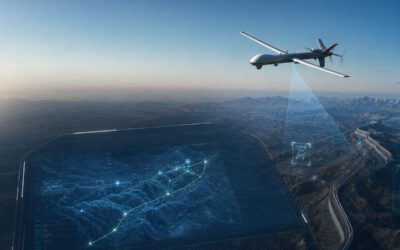
Wide-Area Motion Imagery (or WAMI for short) has been used in military operations for years. Its effectiveness in protecting FOBs and identifying hostile combatant groups on the ground has been immeasurable, especially in difficult and hostile terrain. Now, WAMI is finding a new use in SAR missions. Because the sensors used in modern WAMI systems are incredibly lightweight, they can be easily mounted to airborne platforms such as SAR helicopters or even drones. The extended field of view gives operators a real-time snapshot of the terrain, whether that’s open ground, the ocean or an urban landscape.
By processing that information through highly advanced AI programs and trained human interpreters, data can be readily interpreted, and the SAR teams then directed immediately to the targets. WAMI within SAR systems could save hundreds if not thousands of lives every year simply by giving a much wider image of a search area than traditional narrow-field cameras or static satellite imagery. It also means that you don’t have to carry out numerous passes over the same area, as such a vast area is covered in a short time.
WAMI isn’t the be-all and end-all of SAR imaging. It typically images in medium resolution, so using it in tandem with a high-resolution system is essential. What WAMI does is filter large amounts of data quickly, covering a much larger search area. High-resolution and multi-spectral imaging can then be used to ‘fine-tune’ the data as part of a search and rescue technology package.
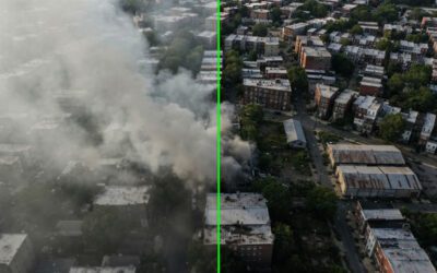
New infra-red WAMI systems are delivering excellent results, especially in the identification of ‘hot spots’ in fire hazard zones. This can allow the WAMI operator to let fire crews on the ground know exactly where fires are likely to occur and their location. In vulnerable environments such as the Australian Outback, the African savanna and areas of the US, Europe and Canada, this system could help to prevent devastating wildfires from taking hold. As we head into a warmer climate shift, that could have real positive consequences for isolated and vulnerable communities.
AI and AR technology
AI has had a lukewarm reception from the public who often see it as a threat rather than a tool. However, when it comes to search and rescue technology AI has an important part to play in the future of more efficient and effective SAR operations. AI can be used to interpret mayday calls, especially if the signal is weak, intermittent, or difficult to hear and understand.
AI can be used to automatically transcribe a distress call and capture vital fragments of data such as latitude and longitude, locational information, or data regarding the condition of an individual which could have a bearing on the urgency of the search.
Augmented Reality provides pilots and crew of airborne SAR units with multiple layering and 3D-rendered mapping that can deliver a wealth of information when flying over complex terrain. For example, if an earthquake has destroyed a city centre, AR technology can provide an overlay that identifies where buildings should be located, even if they have been reduced to rubble.
If a residential block has been damaged, the AR multi-layering can identify exactly where it should be in relation to other buildings. This kind of identification can be exceptionally difficult when a location has suffered terrain-changing damage such as a mudslide, tsunami or earthquake. The additional overlay can help to identify key search areas and direct ground units to those locations.
Search and Rescue Satellite-Aided Tracking (SARSAT)
First developed by NASA in 2009, SARSAT immediately proved to be invaluable in SAR operations. SARSAT was quickly upgraded in 2010 with Distress Altering Satellite Systems or DASS. This, unlike its predecessor, didn’t rely on static weather satellites but used the USAF’s GPS satellites. This gave DASS a major advantage in that it could identify distress targets faster and more accurately. DASS is fully operational and has been helping SAR units locate anyone initiating a distress beacon anywhere in the world for 13 years.
However, not everyone carries a distress beacon. So today, multi-spectral cameras on aerial units are used to scour search areas quickly. By using systems such as OPENSIGHT data from electro-optical, infrared, hyperspectral, Radar, LIDAR and Sonar can all be uploaded from aerial search units and then analysed in real-time by ground command units. The information collated out of this data can then go on to form the basis of revised commands or updated search grids for the ground and airborne units to action.
Ground unit information assessment
Airborne SAR units are not autonomous – they rely on the information received from ground control units to help refine their search parameters, especially in very challenging situations such as a search and rescue mission at sea or in a combat zone. Ground units and command centres need to be able to analyse and interpret data quickly, narrowing down search areas to deploy SAR units (both ground-based and airborne) as efficiently as possible.
To do this, search and rescue equipment and technology need to be fully integrated. The easiest way to do this is to link to satellite technology and then incorporate overlays such as Augmented Reality maps and data points that can give both the operational units and command centres real-time information.
Helmet Mounted and Head Wearable Displays
This technology has been grandfathered from the military, where fighter pilots have been using head mounted and HWDs for quite some time. Now, this technology is making its way into the civilian arena, along with HUDs (Heads Up Displays). This search and rescue technology could make a huge difference in reducing the workload of the pilot and operators, especially during rescues in bad weather.
The technology is also being integrated with additional ClearVision tech, developed by aviation specialists that can reduce visual impairments caused by poor visibility such as fog or smoke, haze and rain. By adding these capabilities to existing functionality such as night vision and infra-red vision, the pilot and onboard operators can see much more detail, making it easier to spot victims on the ground.
Integrate multi-layer spectral analysis and even augmented layers into this system and you have a whole new generation of HWDs that could revolutionise the roles of the onboard crew in SAR airborne units.
Miniaturization – taking technology to the next level
When computers first became commonplace, they were still cumbersome, heavy, and fragile – not criteria that work well in an airborne situation! Today though, thanks to miniaturization, computers and micro-technology have shrunk those once unwieldy objects to a much smaller size. Now, it is possible to install a far greater range of multi-spectral cameras, Augmented Reality systems, and even operational equipment such as load stability systems to enhance the effectiveness and efficiency of airborne SAR units.
Not only is this equipment easy to carry, but it’s simple to operate too. Much of the new technology is plug-in systems that are integrated into existing units within the aircraft. This makes them intuitive for a crew to use right out of the box, reducing training time and getting these systems online and operational much more quickly.
The use of touch screens increases the user-friendly experience, making miniaturized systems more practical and simpler to use.
The future of SAR technology
The future of search and rescue technology is the advancement of three key areas – AI, AR, and robotics. Miniaturization is infiltrating and influencing the development of ‘bots that can crawl into incredibly small spaces, making them invaluable for locating victims of an earthquake or terrorist attack where a building has been toppled.
Currently, SAR robots are large, bulky, and inflexible. But future SAR bots could take their inspiration from the natural world and be more ant-like or snake-like in construction. Miniaturized cameras, multi-spectral sensors and detectors could make ground-based rescue missions much more successful in those 72 ‘golden hours’ after a disaster when there is the highest chance of survival.
The integration of AI and AR will continue apace and is already having hugely beneficial effects on search and rescue technology, especially for airborne units. The coordination of operations will still always have to be in the hands of human beings. But both AI and AR have an increasingly important role to play, alongside continuing advances in search and rescue equipment. Indeed, AR is becoming more integrated into that equipment, and thanks to its user-friendly and intuitive operational features, is proving to be highly successful around the world.
FlySight – An advanced partner in SAR operations
With turnkey solutions and enhanced software solutions ready to go straight out of the box, FlySight’s real-time augmented reality programs and its groundbreaking Mission Console system are specifically designed for airborne operators.
Overlaying multiple high-resolution video and augmented reality layers, Mission Console increases the situational and geospatial awareness of pilots and operators, relaying their exact location and downloading real-time data directly to command centres. Operational monitoring can be done, and commands based on up-to-the-minute data can then be relayed to both the aerial and ground-based units, making SAR operations more streamlined.
We know that lives are on the line. So, our FlySight technology is developed to the highest operational standards for civilian, law enforcement, military, and SAR operations. Find out more by contacting us direct and discover how FlySight is advancing the future of search and rescue technology.
Mobile phone and communication systems in airborne Search and Rescue
FlySight seamlessly integrates OPENSIGHT with top-tier technology, now extending collaboration to Lifeseeker Technologies after a successful partnership with Artemis.
In its unwavering commitment to advancing Search and Rescue (SAR) missions, FlySight has made significant strides by integrating OPENSIGHT with two of the industry’s best-in-class mobile phone detection, location, and communication systems: Artemis by Smith Myers and Lifeseeker by CENTUM.
🎯Go deep into our partnerships and watch the videos