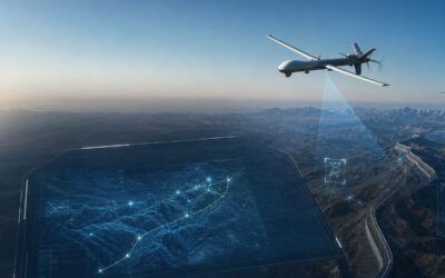
Aerial data collection is a growing concept thanks to massive advances in drone technology. Not only does it allow law enforcement organisations to monitor situations from the air without the need to send up an expensive helicopter, but it also provides a flexible way of measuring traffic flow and congestion.
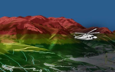
However, nothing can really beat the ‘Eye in the Sky’ and, until drone technology allows operational units to be airborne for prolonged periods, the helicopter will still be a crucial part of traffic monitoring in urban environments. To that end, augmented reality integration into live-stream video data continues to set the benchmark for traffic monitoring.
Why is traffic monitoring so important?
The obvious reason that traffic monitoring is so important is to prevent unnecessary congestion in busy urban areas. However, it’s not just making sure that road users get to work on time but also preventing overly congested roads from leading to increased levels of air pollution. This can reach dangerous levels if most of the roads in the city centre are at a standstill.
Aerial monitoring allows organisations and public services to identify hot spots of congestion, ‘pinch points’ that have a ripple effect on the smooth flow of traffic, and any areas frequently performing below par. They can then revise their traffic flow algorithms accordingly to relieve these blockages, especially at peak times.
Driver behavioural analysis
However, traffic monitoring has another function: the ability to carry out driver behavioural analysis instantly. As it can often be challenging to identify motorised perpetrators on the ground, an aerial monitoring system has a distinct advantage. Not only can it identify and tag a vehicle behaving erratically, but it can also use augmented reality to calculate the vehicle’s velocity and monitor the observed car’s behaviour.
The vehicle’s details, trajectory and any traffic violations observed and recorded by the aerial operator can then be relayed to ground teams, who can then move in to intercept the vehicle.
Is it accurate?
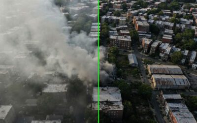
Put simply, yes. The latest augmented reality and analysis software is incredibly accurate and can identify small targets. Even when there is a considerable amount of background noise, a system such as OPENSIGHT can filter out extraneous targets and focus in on single or multiple points of interest. By integrating augmented reality layers, that target can be tracked and monitored with minimal interference and the maximum amount of relevant data, even in an urban environment.
Automatic vehicle detection can also reduce the amount of time aerial operators spend searching for a target. The system will alert the operator as soon as it detects the target vehicle, allowing the operator to monitor the vehicle’s progress. Even details such as the vehicle’s speed can be analysed, which plays an important part in mission protocol (such as instructing ground vehicles to drop back if the pursuit speed could present a risk to the public).
Useful for single vehicles or entire road networks
Automatic vehicle detection provides a comprehensive method of traffic monitoring, examining the flow of a particular road network, uncovering pinch points and bottlenecks in the traffic flow, or identifying a single target vehicle. Regardless of the application, incorporating augmented reality, which can be linked to external automatic vehicle classification systems, makes it a valuable tool for any operator.
This turnkey solution is also intuitive, using icons and a familiar operating system that can be mastered by the operator very quickly. The user-friendly basis makes it easy to operate even on a challenging aerial platform such as a helicopter.
An ‘Eye in the Sky’ is a crucial aspect of traffic monitoring and management. One that incorporates software with automatic vehicle classification and vehicle behaviour analysis adds an extra dimension to the useability of any analytic package. By overlaying augmented reality with real-time video streaming, the operator has instant access to a wealth of useful information.
This kind of traffic monitoring software aims to manage traffic flow, identify individual target vehicles, and create a safer environment for all motorists, pedestrians and road users. Augmented reality software helps aerial units to achieve precisely that.