
Decision Advantage Across Every Domain
Connected. Interoperable. Mission-Driven
Modern operations often no longer take place within a single operational environment. Success depends on the ability to connect information, coordinate assets, and synchronize decisions across air, land, maritime, underwater, and space domains.
FlySight enables Multi-Domain Operations by transforming heterogeneous data into a single operational picture, allowing commanders and operators to understand, coordinate, and act faster than ever before.
At the core of this capability is OPENSIGHT, FlySight’s software-centric mission system, designed to connect sensors, platforms, operators, and command centers regardless of domain or platform. Through advanced data fusion, geospatial intelligence, augmented reality, and artificial intelligence, OPENSIGHT provides a Common Operational Picture that supports decision-making across the entire operational chain.
Its modular open architecture enables seamless integration with existing C4ISR infrastructures, legacy systems, third-party applications, and future technologies, creating a truly interoperable environment for defence, homeland security, and civil protection missions.
Rather than operating independent systems for each domain, organizations can rely on a single software framework capable of supporting coordinated operations between airborne platforms, ground forces, naval assets, unmanned systems, and command centres—turning information superiority into operational advantage.
Related products

ONE PLATFORM. EVERY DOMAIN
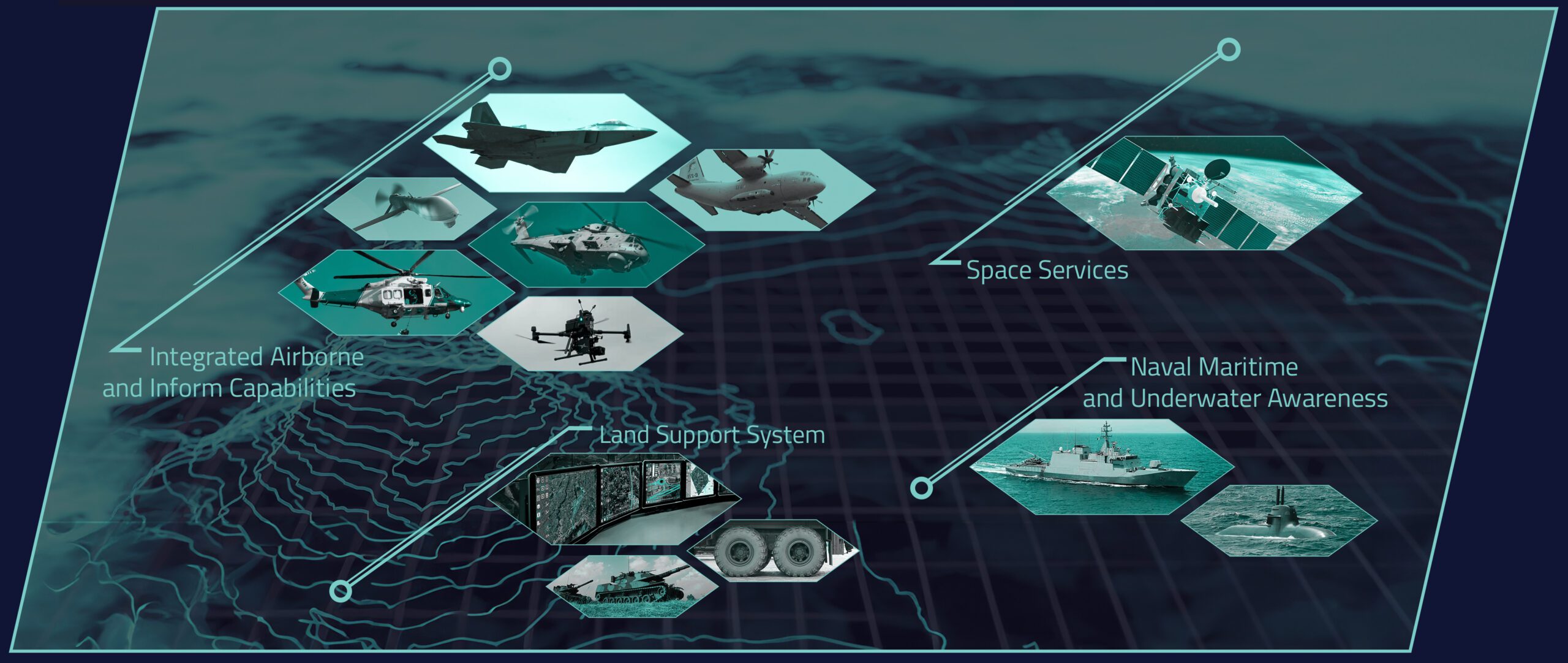
AirBORNE
Advanced Situational Awareness for Airborne Operations
LAND
Operational Intelligence for Land Operations
MARITIME
Decision Intelligence Systems for Maritime & Subsurface Operations
SPACE
Advancing Space Capabilities for Defense and Beyond
Mission Applications
Infrastructure Monitoring
SAR (Search & Rescue)
Firefighting
Law Enforcement
Border Control
ISR (Intelligence, Surveillance, Reconnaissance)
Recce / Tactical Reconnaissance
C-UAS (Counter Unmanned Aircraft Systems)
MUM-T (Manned-Unmanned Teaming)
OPENSIGHT Enables
Unified Multi-Domain Awareness
Create a Common Operational Picture by combining information from multiple operational domains into a single intuitive environment.
Cross-Domain Data Fusion
Fuse EO/IR, radar, AIS, LIDAR, SONAR, SIGINT, UAV data, tactical tracks and geospatial intelligence into one operational view.
Collaborative Decision Making
Share information in real time between airborne crews, ground operators, naval forces and command centres.
Open Architecture
Integrate legacy systems, NATO standards, third-party software and proprietary technologies without vendor lock-in.
AI-Enhanced Operations
Accelerate detection, classification, tracking and threat assessment through integrated Artificial Intelligence and Automatic Target Recognition.
Scalable Deployment
Deploy the same software ecosystem onboard platforms, at tactical command posts or inside strategic command centres.
Key Capabilities
Multi-Domain Data Fusion
Real-time integration of heterogeneous sensors and operational data into a unified operational picture.
Common Operational Picture (COP)
A shared, continuously updated operational environment accessible across organizations and domains.
Multi-Platform Interoperability
Compatible with manned platforms, UAVs, command centres, naval systems and legacy infrastructures.
Open Software Architecture
SDK-based environment supporting third-party modules, STANAG interfaces and future capability growth.
Augmented Reality Visualization
Mission-critical information displayed directly on live video and geospatial environments.
AI & Automatic Target Recognition
Automated detection, classification and tracking to reduce operator workload.
Real-Time Collaboration
Shared operational awareness between distributed operators and multiple agencies.
Mission Planning & Debriefing
Support the complete mission lifecycle from planning through execution to post-mission analysis.
Cross-Domain Information Sharing
Exchange operational information securely between different organizations and operational domains.
Future-Ready Architecture
Designed to evolve with emerging sensors, autonomous systems and next-generation command environments.
Want to know more about OPENSIGHT?
Designed and developed to meet specific needs in any scenario, OPENSIGHT is a multi-platform PED (Processing, Exploitation and Dissemination) system created to provide the best support in decision making.
Contact us, our team is here to help!
