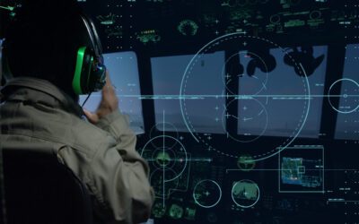
Search and Rescue technology has advanced considerably in the last few years, primarily due to the development of systems that coordinate multidisciplinary components, ranging from geospatial orbit to the ground. Satellites, drones, ground-based technology, and onboard SAR systems, such as FlySight’s OPENSIGHT mission console, are increasing the chances of locating and rescuing survivors significantly. The combination of complex search and rescue systems that interact with one another and can use real-time data analysis to make more informed mission decisions quickly results in a far greater degree of accuracy and effectiveness.
In this article, we’ll examine the current landscape of SAR technology in greater detail, focusing on the specific scenarios in which these systems are particularly effective and how they are being incorporated into aerial platforms, such as helicopters. We’ll look at the different categories of SAR systems, including satellite, drone, and ground-based technology, and the recent advancements, and the technology behind them, such as FlySight’s OPENSIGHT.
What are SAR systems?
Search and Rescue technology has been adapted from other fields, particularly military and law enforcement technologies that focus on reconnaissance and target identification. It makes sense, as the applications developed for these sectors are ideally suited to search and rescue situations, especially in urban or built-up areas.
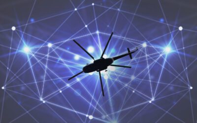
SAR systems are a combination of aerial and ground-based technologies, allowing aerial platforms, such as helicopters and, increasingly frequently, drones, to carry out predetermined search patterns based not only on current information but also on existing data. This Enhanced Reality approach to search and rescue, combined with the use of AI to ‘crunch the data’ far more quickly than a single human ever could, is resulting in improved SAR operations with a positive outcome. Put simply, combining aerial and ground-based SAR technology is saving lives.
The drive for improved search and rescue rates has been supplemented by technological advancement that includes Cloud technology, the ability to use multi-sensory equipment that covers a broader spectrum of both visible and non-visible light, and even the ability to ‘overlay’ data, such as addresses or maps, over terrain that has been dramatically altered by, for example, an earthquake. In a SAR operation, every second counts. So the faster teams can be coordinated both in the air and on the ground, the more successful the outcome is likely to be.
The Golden Hours – why effective SAR technology is so important
When a natural or man-made disaster strikes, SAR teams have just a short time to locate survivors. Generally, it’s accepted that this period, often referred to as the ‘Golden Hours’, is just 72 hours long. In that time, the first responders have massive obstacles to overcome, so it’s not a matter of simply rushing in and starting to look for survivors. Every second requires a dividend, and that begins with information gathering, typically conducted by aerial units such as helicopters, drones, and satellites.
Not only does SAR technology need to locate survivors, but it also has to ensure the safety of rescue teams. This is particularly important in highly volatile situations such as wildfires or avalanches, where shifting weather can put teams who were previously in safe areas in imminent danger.
From unstable structures to hazardous environments, the key is to have up-to-date information to improve situational awareness for rescue teams, as well as to coordinate efforts between ground and air-based crews to maximise effectiveness.
How Search and Rescue technology is used
SAR technology is quietly saving lives in a wide range of situations. To illustrate this, let’s take a look at a selection of how search and rescue technology is applied to different scenarios.
The use of helicopter SAR systems by firefighters attending to forest fires
Forest fires are notoriously difficult to predict, let alone control. When you introduce the issue of human habitations being threatened by these fires, as we’ve seen in California in particular in recent years, the cost in human life and destruction of property can be extreme.
Helicopters are the ‘eyes in the sky’ when a forest fire is reported. Using multispectral cameras, they can search for ‘hot spots’ beneath the canopy, even when there is no visible indication of a fire. They can also use integrated topographical maps to determine the fire’s potential path and where ground crews can most effectively set up fire breaks to halt its spread.
Additional technology, such as OPENSIGHT’s High-Performance Video Processing features, includes ‘dehazing’, which provides operators with a clearer view of the ground even in hazy environments, such as those affected by smoke or fog. OPENSIGHT Mission Console also includes a footprint heatmap capability, offering operators a real-time visual representation of areas already covered during a mission. This feature is particularly valuable in SAR operations, allowing crew members to avoid redundant searches and optimize coverage of unsearched areas. By highlighting “hot spots” that required more investigation time, the heatmap ensures that no critical details are overlooked, improving both speed and accuracy in time-sensitive scenarios. Whether it’s scanning for individuals in a search and rescue effort or identifying potential hazards in an urban surveillance operation, this new system’s ground image scanning capability equips users with an additional layer of situational awareness, further enhancing their speedy decision-making abilities.
Flood response with drone-based SAR mapping
Drone-based SAR (Synthetic Aperture Radar) mapping enables both operational managers and first responders to work with accurate information when dealing with a flooding emergency. Drone-based SAR is a sophisticated imaging technology that builds upon our previous discussion of OPENSIGHT’s advanced video processing software, enabling operators to see through cloud cover, low-light conditions, and smoke.
Delivering high-resolution imagery of affected areas, it can also collate real-time data initially without risking human response teams. This technology can also be used in helicopter platforms for more detailed analysis of the situation, including mapping infrastructure damage and even detecting changes over time in flood-prone areas.
Locating missing persons in remote terrain
Automatic Target Recognition (ATR) is primarily associated with law enforcement and military operations. However, this advanced satellite and aerial-based technology also plays a crucial role in locating missing persons, particularly in remote terrain. Seeing an individual on the ground from a helicopter, especially if they are hidden by the terrain, is incredibly difficult. Using ATR can significantly speed up the process, eliminating ‘false positives’ and flagging potential targets that can then be verified by ground or aerial-based personnel.
This technology is also shifting to drone use, with satellites providing terrain overviews and deep learning software scanning for anomalies, such as shapes and textures associated with human beings rather than ‘background noise’.
Avalanche rescue with mobile SAR beacons and drones
Every year, at least 100 people are seriously injured or killed as a result of avalanches in Europe. Avalanche transceivers or personal beacons worn by skiers, mountain rescue teams and mountaineers have been shown to cut the death rate from 70.6% to 55.2% by cutting the rescue time from over two hours to just 25 minutes. Mobile SAR beacons send out a signal when a victim has been buried by an avalanche, allowing drones and rescue teams to locate them much quicker.
Modern UAVs and drones are ideal for use in these situations, as they are less likely to cause further avalanches due to rotor downdrafts and vibrations from a larger helicopter, and are also capable of handling extreme conditions.
Maritime and mountain rescue operations by the Canadian Air Rescue Service
The SAR technology onboard the CH-149 Cormorant rescue helicopter is at the forefront of modern Search and Rescue procedures. With such a vast area to cover, the Royal Canadian Air Force SAR teams are at the forefront of operational applications for the latest SAR systems. A part of this is to improve and enhance situational awareness, and to that end, the RCAF have incorporated FlySight’s OPENSIGHT that includes:
- Augmented reality (AR) overlays for real-time visual mapping
- Advanced moving maps and high-fidelity video feeds
- Integration with onboard sensors for dynamic mission planning
- Optimised interface for SAR operators to reduce search times and improve target identification
The technology behind SAR systems
What makes SAR systems so effective at search and rescue, no matter the use case? The main reason is that the technology is fully integrated into existing hardware that’s user-friendly and intuitive to use. This cuts training time and ensures every minute in the air is a productive and efficient use of resources. The variety of systems in use also uses both Enhanced Reality (such as overlay geo-mapping) and AI machine learning for pattern recognition (for example, in the use of target identification).
Real-time geospatial mapping provides operators with the maximum amount of information at their fingertips, even when the terrain below has irreversibly changed due to a natural disaster. Meanwhile, seamless integration between airborne units, ground crews, and satellite communications ensures that extremely fluid situations can be responded to in real-time.
At the leading edge of Search and Rescue technology is FlySight’s OPENSIGHT Mission Console. A wealth of integrated features and plug-ins allows this innovative platform to be tailored to suit the specific needs of SAR teams, whether they work at sea, over land, in urban areas or remote regions. OPENSIGHT combines a selection of Wide-Area Motion Imagery (WAMI) systems, as well as AI and Enhanced Reality technology, alongside multispectral cameras and ClearVision technology, which provides crews with a far clearer view of the terrain. Augmented mapping and the ability to feed data directly to the Cloud for instant access by command centres, as well as linking to satellite data, enable commanders to reassess in real-time and change mission parameters as the situation develops. All of this means those ‘Golden Hours’ can be utilised to maximum effect, and more lives can be saved as a result.
For information about OPENSIGHT, take a tour of our informative videos detailing the operating system in more depth, or contact us now to learn more about the OPENSIGHT system for search and rescue operations.
Focus on OPENSIGHT & SAR Operations